Kinston in Lenoir County, North Carolina — The American South (South Atlantic)
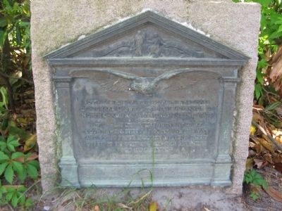
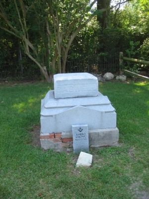
Grave of Richard Caswell
"I will most cheerfully join any of my countrymen, even as a rank and file man, and whilst I have blood in my veins freely offer it in support of the liberties of my country."
(Caswell to his son in 1775)
Erected 1919 by the North Carolina Historical Commission, Citizens of Lenoir County, and Caswell-Nash Chapter, D.A.R.
Topics and series. This historical marker is listed in these topic lists: Government & Politics • War, US Revolutionary. In addition, it is included in the Daughters of the American Revolution series list.
Location. 35° 16.094′ N, 77° 37.223′ W. Marker is in Kinston, North Carolina, in Lenoir County. Marker is on West Vernon Avenue (Route 70/258), on the right when traveling east. Located in front of the CSS Neuse and Caswell State Historic Site. Touch for map. Marker is in this post office area: Kinston NC 28504, United States of America. Touch for directions.
Other nearby markers. At least 8 other markers are within 3 miles of this marker, measured as the crow flies. Richard Caswell (within shouting distance of this marker); Moving the CSS Neuse (about 400 feet away, measured in a direct line); Walk of Honor Memorial (approx. 2.2 miles away); Cat Hole (approx. 2.2 miles away); CSS Neuse Confederate Ironclad Gunboat (approx. 2.2 miles away); Birth of Funk (approx. 2.3 miles away); Kinston Sit-Ins (approx. 2.3 miles away); CSS Neuse (approx. 2.3 miles away). Touch for a list and map of all markers in Kinston.
Credits. This page was last revised on March 9, 2021. It was originally submitted on May 8, 2010, by Craig Swain of Leesburg, Virginia. This page has been viewed 1,478 times since then and 50 times this year. Photos: 1, 2, 3. submitted on May 8, 2010, by Craig Swain of Leesburg, Virginia.


