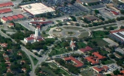
Northeast Side in Randolph Air Force Base in Bexar County, Texas — The American South (West South Central)
Building 100
"The Taj Mahal"
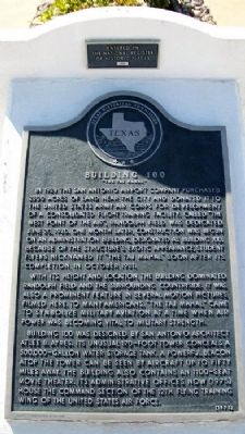
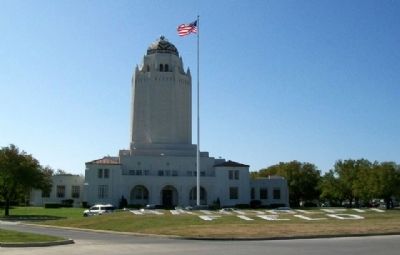
In 1928 the San Antonio Airport Company purchased 2300 acres of land near the city and donated it to the United States Army Air Corps for development of a consolidated flight training facility. Called “The West Point of the Air”, Randolph Field was dedicated June 20, 1930. One month later, construction was begun on an administration building, designated as Building 100. Because of the structure's exotic appearance, student flyers nicknamed it “The Taj Mahal” soon after its completion in October 1931.
With its height and location, the building dominated Randolph Field and the surrounding countryside. It was also a prominent feature in several motion pictures filmed here. To many Americans, “The Taj Mahal” came to symbolize military aviation at a time when air power was becoming vital to military strength.
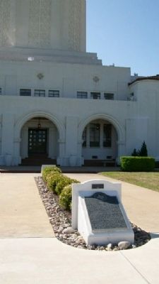
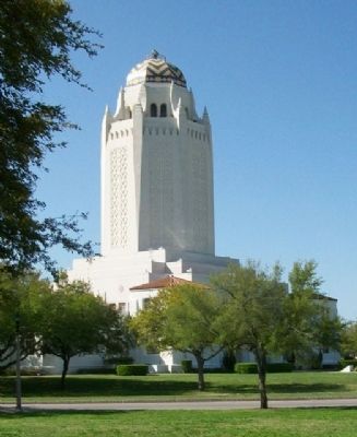
Building 100 was designed by San Antonio architect Atlee B. Ayres. Its unusual 170-foot tower conceals a 500,000-gallon water storage tank. A powerful beacon atop the tower can be seen by aircraft up to fifty miles away. The building also contains an 1100-seat movie theater. Its administrative offices now (1975) house the command section of the 12th Flying Training Wing of the United States Air Force.
Erected 1975 by Texas Historical Commission. (Marker Number 567.)
Topics and series. This historical marker is listed in these topic lists: Air & Space • Architecture • Education. In addition, it is included in the National Historic Landmarks series list. A significant historical date for this entry is June 20, 1915.
Location. 29° 32.181′ N, 98° 16.975′ W. Marker is in Randolph Air Force Base, Texas, in Bexar County. It is in the Northeast Side. Marker is at the intersection of Washington Circle and Northwest Drive, on the right when traveling east on Washington Circle. Access is restricted due to Randolph AFB being an active military installation. Touch for map. Marker is in this post office area: Jbsa Randolph TX 78150, United States of America. Touch for directions.
Other nearby markers. At least 8 other markers are within 3 miles of this marker, measured as the crow flies. Missing Man Monument (within shouting distance of this marker); Post Chapel (about 300 feet away, measured in a direct line); Post Exchange (about 300 feet away); PX Filling Station (about 500 feet away); Gas and Electric Sub Station (about 500 feet away); Cessna T-37 Tweet (approx. 0.2 miles away); Edens Cemetery (approx. 1˝ miles away); Schertz (approx. 2.3 miles away). Touch for a list and map of all markers in Randolph Air Force Base.
Credits. This page was last revised on February 2, 2023. It was originally submitted on June 2, 2010, by William Fischer, Jr. of Scranton, Pennsylvania. This page has been viewed 1,838 times since then and 67 times this year. Last updated on July 11, 2022, by Joe Lotz of Denton, Texas. Photos: 1, 2, 3, 4. submitted on June 2, 2010, by William Fischer, Jr. of Scranton, Pennsylvania. 5. submitted on August 1, 2010, by William Fischer, Jr. of Scranton, Pennsylvania. • J. Makali Bruton was the editor who published this page.
