Southwest Waterfront in Southwest Washington in Washington, District of Columbia — The American Northeast (Mid-Atlantic)
Blending Old and New
River Farms to Urban Towers
— Southwest Heritage Trail —
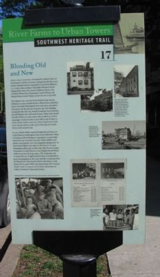
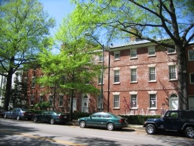
When urban renewal threatened to destroy three of Washington's oldest structures, dating from the late 1700's, history-minded citizens organized to stop the bulldozers. As a result, when architect Chloethiel Woodard Smith designed the mid-20th century Harbour Square, she included Wheat Row, Duncanson-Cranch House, and Edward Simon Lewis House, as you can see to your left.
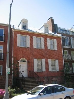
The elegant 1794-1795 set of four Federal style houses behind you across Fourth Street is Wheat Row, created by James Greenleaf, Washington's first real estate speculator. Greenleaf and his partners hoped to get rich building housing for the new city. Instead Greanleaf went bankrupt, but left behind a few well-made houses. These were named for John Wheat, an early owner who worked as a Senate messenger. Across Fourth to your left at 456 N Street is Lewis House, built in 1817 for a Navy Department clerk. A few houses down at 468-470 is Duncanson-Cranch House, built around 1794.
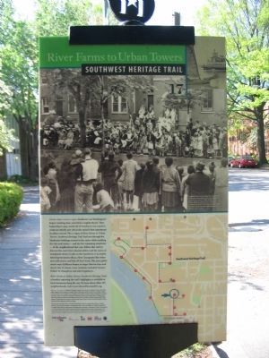
In 1901 Charles Weller opened Neighborhood House in Lewis House as Washington's first social settlement. There, in keeping with Washington's segregation, he provided education and recreation for poor white children and adults, including the city's first organized playground. Its first branch library was open to all, however. In 1904 Washington artist and socialite Alice Pike Barney bought Duncanson-Cranch House so that Neighborhood House could move into the larger space. The institution was re-named Barney Neighborhood House. It continued to grow, desegregating in the 1940s and also occupying three of Wheat Row's four houses before relocating to 16th Street, NW in 1960. Weller also helped begin the "Colored Social Center" in 1903 at 118 M Street, forerunner of today's Southwest Community House.
Erected 2004 by Cultural Tourism DC. (Marker Number 17.)
Topics and series. This historical marker is listed in this topic list: Architecture. In addition, it is included in the Southwest Heritage Trail series list. A significant historical year for this entry is 1817.
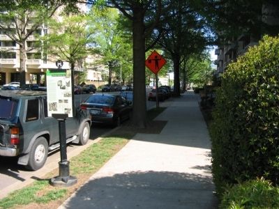
Location. 38° 52.487′ N, 77° 1.047′ W. Marker is in Southwest Washington in Washington, District of Columbia. It is in Southwest Waterfront. Marker is at the intersection of 4th Street Southwest and N Street Southwest, on the right when traveling north on 4th Street Southwest. Touch for map. Marker is at or near this postal address: 393 N St SW, Washington DC 20024, United States of America. Touch for directions.
Other nearby markers. At least 8 other markers are within walking distance of this marker. Lewis House (within shouting distance of this marker); Wheat Row (about 300 feet away, measured in a direct line); Barney House (about 400 feet away); Harbour Square (about 400 feet away); Suggs Plaza
(about 500 feet away); Recreation and River Park (about 500 feet away); Linking the "Island" to the City (about 600 feet away); Change on the Waterfront (about 600 feet away). Touch for a list and map of all markers in Southwest Washington.
More about this marker.
(Upper Right Photo Caption):
The Lewis House, far left, at 456 N Street, was Barney Neighborhood House's first home, until moved to Duncanson-Cranch House at 468-470, left. After urban renewal, both houses became part of Harbour Square along with Wheat Row, 1315-1321 Fourth Street, above.
(Center Right Photo Caption):
Artist Garnet Jex photographed the Duncanson-Cranch House in 1963 as construction was underway for Harbour Square cooperatives.
(Lower Right Photo Captions):
Barney Neighborhood House brochure of 1908, above. Adult classes included vegetable carving, 1942.
(Lower Left Photo Caption):
Beloved World War II correspondent Ernie Pyle, center, once lived in a Lewis House apartment.
Credits. This page was last revised on March 16, 2024. It was originally submitted on July 3, 2010, by Craig Swain of Leesburg, Virginia. This page has been viewed 1,163 times since then and 23 times this year. Last updated on March 8, 2019, by Devry Becker Jones of Washington, District of Columbia. Photos: 1, 2, 3, 4, 5. submitted on July 3, 2010, by Craig Swain of Leesburg, Virginia. • Bill Pfingsten was the editor who published this page.
