Marker Logo HMdb.org THE HISTORICAL
MARKER DATABASE
“Bite-Size Bits of Local, National, and Global History”
Crownsville in Anne Arundel County, Maryland — The American Northeast (Mid-Atlantic)
 

Mt. Tabor United Methodist Church


Mt. Tabor United Methodist Church Marker image. Click for full size.
Photographed By F. Robby, November 5, 2007
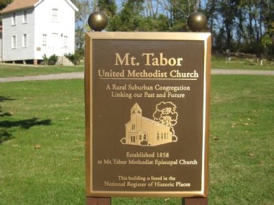
1. Mt. Tabor United Methodist Church Marker
Inscription. A rural suburban congregation linking our past and future. Established 1858 as Mt. Tabor Methodist Episcopal Church. This building is listed on the National Register of Historic Places.
 
Topics. This historical marker is listed in this topic list: Churches & Religion. A significant historical year for this entry is 1858.
 
Location. 39° 0.433′ N, 76° 37.847′ W. Marker is in Crownsville, Maryland, in Anne Arundel County. Marker is at the intersection of St. Stephens Church Road and Edwin Lane, on the right on St. Stephens Church Road. Touch for map. Marker is at or near this postal address: 1421 St Stephens Church Road, Crownsville MD 21032, United States of America. Touch for directions.
 
Other nearby markers. At least 8 other markers are within 4 miles of this marker, measured as the crow flies. Linthicum Walks (approx. 2.2 miles away); Chapel of Ease (approx. 2˝ miles away); Birthplace of Johns Hopkins (approx. 2.6 miles away); Belvoir (approx. 2.7 miles away); Henry Baldwin (approx. 2.8 miles away); Count de Rochambeau’s (approx. 3 miles away); Middle Plantation (approx. 3.3 miles away); Anne Arundel Academy (approx. 3.4 miles away). Touch for a list and map of all markers in Crownsville.
 
Paid Advertisement
Click on the ad for more information.
Please report objectionable advertising to the Editor.
Click or scan to see
this page online
Mt. Tabor Church image. Click for full size.
Photographed By F. Robby, November 5, 2007
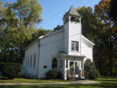
2. Mt. Tabor Church
Mt. Tabor Good Samaritan Lodge image. Click for full size.
Photographed By F. Robby, November 5, 2007
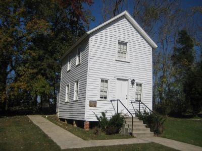
3. Mt. Tabor Good Samaritan Lodge
This building is adjacent to the Mt. Tabor church and is also listed as a notable Crownsville building.
Watkins Slave Cemetary Marker image. Click for full size.
Photographed By F. Robby, December 30, 2003
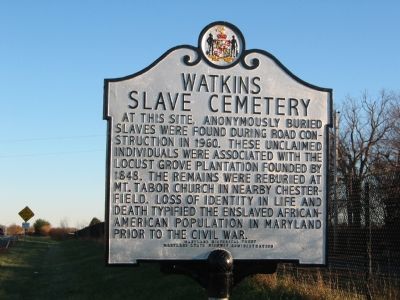
4. Watkins Slave Cemetary Marker
This marker, located just south of the US 50 overpass over Davidsonville Road (MD 424) in Davidsonville, states that slave remains found during road construction in 1960 were reburied at the Mt. Tabor Church.
 
 
Credits. This page was last revised on June 16, 2016. It was originally submitted on November 8, 2007, by F. Robby of Baltimore, Maryland. This page has been viewed 2,594 times since then and 45 times this year. Photos:   1, 2, 3, 4. submitted on November 8, 2007, by F. Robby of Baltimore, Maryland. • J. J. Prats was the editor who published this page.
Share this page.  
Share on Tumblr
m=3412

CeraNet Cloud Computing sponsors the Historical Marker Database.
This website earns income from purchases you make after using our links to Amazon.com. We appreciate your support.
Paid Advertisement
Apr. 26, 2024