Wallula in Walla Walla County, Washington — The American West (Northwest)
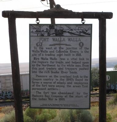
Fort Walla Walla
To the west, at the junction of the Walla Walla and Columbia Rivers, is the site of a trading post built in 1818.
Fort Walla Walla was a vital link in the region’s fur trade, and helped open up the Northwest to the white man. From this post traders and trappers pushed into the rich Snake River basin.
Pioneers on the overland trek to the Oregon country in the 1840’s found its farms a source of supply, and employees were among the area’s first permanent settlers.
The fort was abandoned by Hudson’s Bay Company the start of the Indian War in 1855.
Erected by Washington State Highway Commission in Cooperation with the State Parks and Recreation Commission. (Marker Number 38.)
Topics. This historical marker is listed in these topic lists: Forts and Castles • Settlements & Settlers. A significant historical year for this entry is 1818.
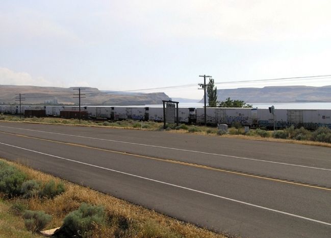
Location. 46° 5.062′ N, 118° 54.582′ W. Marker is in Wallula, Washington, in Walla Walla County. Marker is on U.S. 12, 1.1 miles south of Boise Cascade Road, on the right when traveling south. Touch for map. Marker is in this post office area: Wallula WA 99363, United States of America. Touch for directions.
Other nearby markers. At least 7 other markers are within 11 miles of this marker, measured as the crow flies. Fort Nez Percés / Fort Walla Walla (a few steps from this marker); Here Stood Fort Nez Perce (a few steps from this marker); The History of Wallula (approx. 2.4 miles away); a different marker also named The History of Wallula (approx. 2.4 miles away); Lewis and Clark Trail (approx. 10.3 miles away); Ainsworth (approx. 10.8 miles away); Sacagawea (approx. 10.8 miles away).
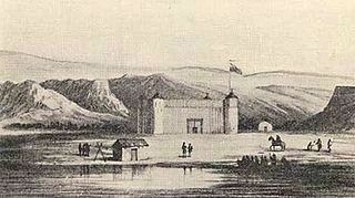
Regarding Fort Walla Walla. This location is often referred to as Old Fort Walla Walla to distinguish it from later forts of the same name that was used by the U.S. Army until 1910.
Old Fort Walla Walla is also referred to as Fort Nez Percés or Fort Nez Percé.
Also see . . . Fort Nez Percés. Wikipedia entry (Submitted on September 16, 2022, by Larry Gertner of New York, New York.)
Credits. This page was last revised on September 16, 2022. It was originally submitted on August 18, 2010, by PaulwC3 of Northern, Virginia. This page has been viewed 1,285 times since then and 41 times this year. Photos: 1. submitted on August 18, 2010, by PaulwC3 of Northern, Virginia. 2. submitted on September 16, 2022, by Larry Gertner of New York, New York. 3. submitted on August 18, 2010, by PaulwC3 of Northern, Virginia.


