Magna in Salt Lake County, Utah — The American Mountains (Southwest)
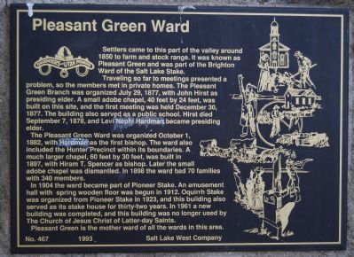
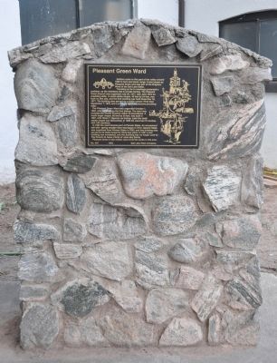
Pleasant Green Ward
Traveling so far to meetings presented a problem, so members met in private homes. The Pleasant Green Branch was organized July 29, 1877, with John Hirst as presiding elder. A small adobe chapel, 40 feet by 24 feet, was built on this site, and the first meeting was held December 30, 1877. The building also served as a public school. Hirst died September 7, 1878, and Levi Nephi Hardman became presiding elder.
The Pleasant Green Ward was organized October 1, 1882, with Hardman as the first bishop. The ward also included the Hunter Precinct within its boundaries. A much larger chapel, 60 feet by 30 feet, was built in 1897, with Hiram T. Spencer as bishop. Later the small adobe chapel was dismantled. In 1898 the ward had 70 families with 340 members.
In 1904 the ward became part of Pioneer Stake. An amusement hall with spring wooden floor was begun in 1912. Oquirrh Stake was organized from Pioneer Stake in 1923, and this building also served as its stake house for thirty-two years. In 1961 a new building was completed, and this building was no longer used by The Church of Jesus Christ of Latter-day Saints.
Pleasant Green is the mother ward of all the wards in this area.
Erected 1993 by Salt Lake West Company of the Daughters of Utah Pioneers. (Marker Number 467.)
Topics and series. This historical marker is listed in this topic list: Churches & Religion. In addition, it is included in the Daughters of Utah Pioneers series list. A significant historical date for this entry is July 29, 1836.
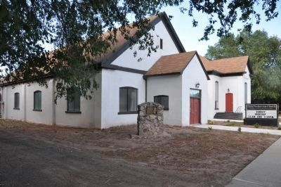
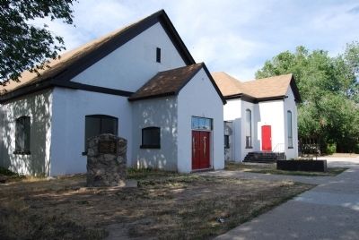
Location. 40° 42.675′ N, 112° 5.902′ W. Marker is in Magna, Utah, in Salt Lake County. Marker is at the intersection of 2700 South and Titanium Drive (8650 W) when traveling east on 2700 South. Marker is at the northeast corner of the intersection near the Christ Presbyterian Church. Touch for map. Marker is at or near this postal address: 8630 W 2700 South, Magna UT 84044, United States of America. Touch for directions.
Other nearby markers. At least 8 other markers are within 8 miles of this marker, measured as the crow flies. Early Magna Settlements (approx. 2 miles away); Relief Society Granary (approx. 2 miles away); Hunter (approx. 3.6 miles away); A Struggle For Water (approx. 5.3 miles away); Monroe Community School (approx. 5.9 miles away); Early Granger Schools (approx. 5.9 miles away); Garfield & Lake Point Resorts (approx. 7.4 miles away); Pioneer Black Rock Resort (approx. 7.4 miles away). Touch for a list and map of all markers in Magna.
Regarding Pleasant Green Ward. While the LDS Church ceased to use this building in 1961, once again it serves as the gathering place for another religion.
Credits. This page was last revised on June 16, 2016. It was originally submitted on June 25, 2007, by Dawn Bowen of Fredericksburg, Virginia. This page has been viewed 2,001 times since then and 32 times this year. Last updated on August 30, 2010, by Bryan R. Bauer of Kearns, Ut 84118. Photos: 1. submitted on June 25, 2007, by Dawn Bowen of Fredericksburg, Virginia. 2, 3. submitted on August 30, 2010, by Bryan R. Bauer of Kearns, Ut 84118. 4. submitted on June 25, 2007, by Dawn Bowen of Fredericksburg, Virginia. • Kevin W. was the editor who published this page.


