Claremont in Surry County, Virginia — The American South (Mid-Atlantic)
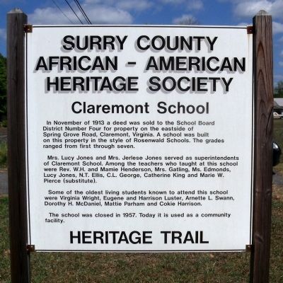
Claremont School
Claremont School
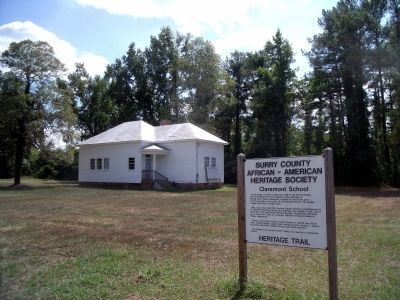
In November of 1913 a deed was sold to the School Board District Number Four for property on the eastside of Spring Grove Road, Claremont, Virginia. A school was built on this property in the style of Rosenwald Schools. The grades ranged from first through seven.
Mrs. Lucy Jones and Mrs. Jerlese Jones served as superintendents of Claremont School. Among the teachers who taught at this school were Rev. W.H. and Mamie Henderson, Mrs. Gatling, Ms. Edmonds, Lucy Jones, N.T. Ellis, C.L. George, Catherine King and Marie W. Pierce (substitute).
Some of the oldest living students known to attend this school were Virginia Wright, Eugene and Harrison Luster, Arnette L. Swann, Dorothy H. McDaniel, Mattie Parham and Cokie Harrison.
The school was closed in 1957. Today it is used as a community facility.
Heritage Trail
Erected by Surry County African-American Heritage Society.
Topics. This historical marker is listed in these topic lists: African Americans • Education. A significant historical month for this entry is November 1913.
Location. 37° 13.036′ N, 76° 58.049′ W. Marker is in Claremont, Virginia, in Surry County. Marker is on Spring Grove Road (Virginia Route 646) 0.1 miles south of Cabin Point Road (Virginia Route 613), on the left when traveling south. Touch for map. Marker is in this post office area: Claremont VA 23899, United States of America. Touch for directions.
Other nearby markers. At least 8 other markers are within 6 miles of this marker, measured as the crow flies. Claremont (about 400 feet away, measured in a direct line); Quioughcohanach Indians (approx. ¾ mile away); Swann’s Point (approx. 3.6 miles away); Wakefield and Pipsico (approx. 3.6 miles away); Temperance Industrial and Collegiate Institute (approx. 3.6 miles away); Cabin Point (approx. 4.2 miles away); Paspahegh Indians (approx. 5½ miles away); Piney Grove and E. A. Saunders (approx. 5½ miles away). Touch for a list and map of all markers in Claremont.
Credits. This page was last revised on November 14, 2021. It was originally submitted on September 20, 2010, by Bernard Fisher of Richmond, Virginia. This page has been viewed 977 times since then and 38 times this year. Photos: 1, 2. submitted on September 20, 2010, by Bernard Fisher of Richmond, Virginia.

