Brundidge in Pike County, Alabama — The American South (East South Central)
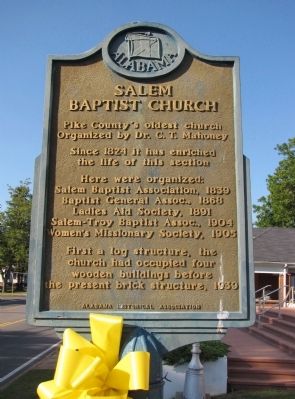
Salem Baptist Church
Organized by Dr. C.T. Mahoney
Since 1824 it has enriched
the life of this section
Here were organized:
Salem Baptist Association, 1839
Baptist General Assoc., 1868
Ladies Aid Society, 1891
Salem-Troy Baptist Assoc., 1904
Women's Missionary Society, 1905
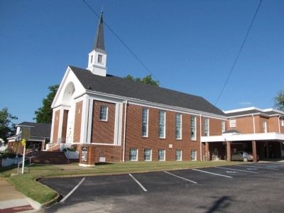
First a log structure, the church had occupied four wooden buildings before the present brick structure, 1939
Erected by Alabama Historical Association.
Topics and series. This historical marker is listed in this topic list: Churches & Religion. In addition, it is included in the Alabama Historical Association series list. A significant historical year for this entry is 1824.
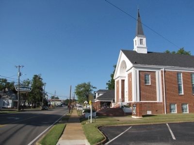
Location. 31° 43.031′ N, 85° 48.935′ W. Marker is in Brundidge, Alabama, in Pike County. Marker is on South Main Street (Alabama Route 93) north of Lee Street, on the right when traveling north. Touch for map. Marker is at or near this postal address: 217 South Main Street, Brundidge AL 36010, United States of America. Touch for directions.
Other nearby markers. At least 8 other markers are within 10 miles of this marker, measured as the crow flies. "Lest We Forget" (about 500 feet away, measured in a direct line); City of Brundidge and the Bass House / Brundidge's Peanut Butter Heritage (about 600 feet away); Philadelphia Presbyterian Church (approx. 1.4 miles away); Williams Chapel United Methodist Church (approx. 2.9 miles away); Monticello (approx. 7.7 miles away); Veterans Memorial Bridge - 1921 / Grist Mill - Indian Battle - Recreation (approx. 8.6 miles away); Veterans Memorial (approx. 9.2 miles away); Hobdy's Bridge: Last Indian Battles in Alabama (approx. 9.8 miles away). Touch for a list and map of all markers in Brundidge.
Also see . . . Salem Baptist Church. (Submitted on October 4, 2010, by Lee Hattabaugh of Capshaw, Alabama.)
Credits. This page was last revised on June 16, 2016. It was originally submitted on October 4, 2010, by Lee Hattabaugh of Capshaw, Alabama. This page has been viewed 989 times since then and 33 times this year. Photos: 1, 2, 3. submitted on October 4, 2010, by Lee Hattabaugh of Capshaw, Alabama. • Bill Pfingsten was the editor who published this page.


