Near Shiprock in San Juan County, New Mexico — The American Mountains (Southwest)
New Mexico
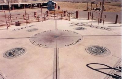
(Four Corners)
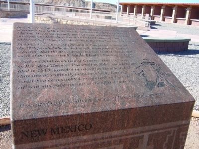
In 1868, U.S. Surveyor Ehud N. Darling surveyed the 37 parallel of latitude to establish the territorial boundary of Colorado and New Mexico. He placed specially marked stones at intervals along the surveyed line that started at the northeast corner of New Mexico and ended 8192 feet west of what is now the Four Corners Monument.
In 1903, U.S. surveyor Howard B. Carpenter resurveyed the 37th parallel along a technically more precise location, reporting that the new survey line was located significantly north of the line established by Ehud N. Darling in 1868.
Neither a joint Resolution of Congress that was vetoed by President Theodore Roosevelt in 1908, nor a lawsuit filed in 1919 succeeded in relocating the established state line as originally monumented by Darling, which had been accepted, recognized and used by citizens and governments as the official state line.
Erected by National Society of Professional Surveyors.
Topics and series. This historical marker is listed in this topic list: Notable Places. In addition, it is included in the Former U.S. Presidents: #26 Theodore Roosevelt series list. A significant historical year for this entry is 1868.
Location. 36° 59.937′ N, 109° 2.707′ W. Marker is near Shiprock, New Mexico , in San Juan County. Marker can be reached from 4 Corners Road, half a mile west of U.S. 160. Touch for map. Marker is in this post office area: Shiprock NM 87420, United States of America. Touch for directions.
Other nearby markers. At least 6 other markers are within 12 miles of this marker, measured as the crow flies. Four Corners – A Common Bond (here, next to this marker); Arizona (a few steps from this marker in Arizona); Colorado (a few steps from this marker in Colorado); Utah (within shouting distance of this marker in Utah); Welcome to Four Corners Monument! (approx. ¼ mile away); Beclabito Dome (approx. 11.7 miles away).
Credits. This page was last revised on August 1, 2020. It was originally submitted on October 4, 2010, by Bill Kirchner of Tucson, Arizona. This page has been viewed 926 times since then and 30 times this year. Photos: 1, 2. submitted on October 4, 2010, by Bill Kirchner of Tucson, Arizona. 3. submitted on October 5, 2010, by Mike Stroud of Bluffton, South Carolina. • Syd Whittle was the editor who published this page.


