Mount Pleasant in Charleston County, South Carolina — The American South (South Atlantic)
Haddrell's Point
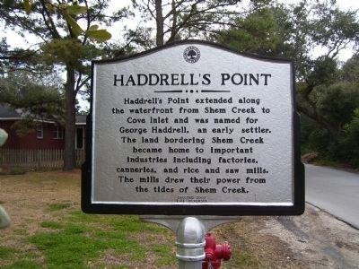
Haddrell’s Point extended along the waterfront from Shem Creek to Cove Inlet and was named for George Haddrell, an early settler. The land bordering Shem Creek became home to important industries including factories, canneries, and rice and saw mills. The mills drew their power from the tides of Shem Creek.
(Reverse):
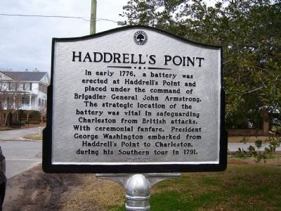
In early 1776, a battery was erected at Haddrell’s Point and placed under the command of Brigadier General John Armstrong. The strategic location of the battery was vital in safeguarding Charleston from British attacks. With ceremonial fanfare, President George Washington embarked from Haddrell’s Point to Charleston, during his Southern tour in 1791.
Erected 2007.
Topics. This historical marker is listed in these topic lists: Settlements & Settlers • War, US Revolutionary. A significant historical year for this entry is 1776.
Location. 32° 47.353′ N, 79° 52.992′ W. Marker is in Mount Pleasant, South Carolina, in Charleston County. Marker is at the intersection of Haddrell Street and Live Oak Drive, on the right when traveling east on Haddrell Street. Touch for map. Marker is in this post office area: Mount Pleasant SC 29464, United States of America. Touch for directions.
Other nearby markers. At least 8 other markers are within walking distance of this marker. The Ferry Tract (approx. 0.2 miles away); Hibben House (approx. 0.2 miles away); Hibben House / British Occupation (approx. 0.2 miles away); Mount Pleasant Presbyterian Church (approx. 0.3 miles away); Shem Creek (approx. 0.3 miles away); The Whilden House / 54th Massachusetts Regiment (approx. 0.3 miles away); Mount Pleasant Home for Destitute Children (approx. 0.4 miles away); Pitt Street Merchants (approx. 0.4 miles away). Touch for a list and map of all markers in Mount Pleasant.
Credits. This page was last revised on May 22, 2020. It was originally submitted on October 7, 2010. This page has been viewed 1,519 times since then and 61 times this year. Photos: 1, 2, 3. submitted on October 7, 2010. • Craig Swain was the editor who published this page.


