Kinderhook in Columbia County, New York — The American Northeast (Mid-Atlantic)
Farmhands and Fishing
Martin Van Buren Nat’l Hist Site
— National Park Service —
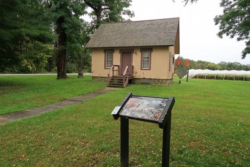
Over the years, Martin Van Buren enlarged his farm from 137 acres to 221 acres through three transactions. Throughout his ownership he relied on employees to perform the labor necessary to make Lindenwald’s acreage productive. In September of 1843 he purchased a 12.5 acre parcel, known as the south meadow, for $1225.50. The meadow and the area surrounding it are depicted in this detail of a rendering of Lindenwald as it looked about 1850. An ardent fisherman, Van Buren had two ponds constructed on this parcel and later stocked them with trout, pickerel and perch.
Erected by National Park Service.
Topics and series. This historical marker is listed in these topic lists: Notable Buildings • Notable Places. In addition, it is included in the Former U.S. Presidents: #08 Martin Van Buren series list. A significant historical month for this entry is September 1843.
Location. 42° 22.104′ N, 73° 42.249′ W. Marker is in Kinderhook, New York, in Columbia County. Marker is on New York State Route 9H, on the right when traveling south. Marker is on the grounds of the Martin Van Buren National Historic Site. Touch for map. Marker is in this post office area: Kinderhook NY 12106, United States of America. Touch for directions.
Other nearby markers. At least 8 other markers are within walking distance of this marker. Lindenwald (about 400 feet away, measured in a direct line); Farm Operations (about 500 feet away); 1849-50 A House Transformed (about 500 feet away); Fallen White Mulberry Tree (about 500 feet away); Lindenwald and the Old Post Road (about 500 feet away); An Agrarian Lifestyle… (about 600 feet away); Fertile Political Ground (about 600 feet away); Marble Mounting Block (about 600 feet away). Touch for a list and map of all markers in Kinderhook.
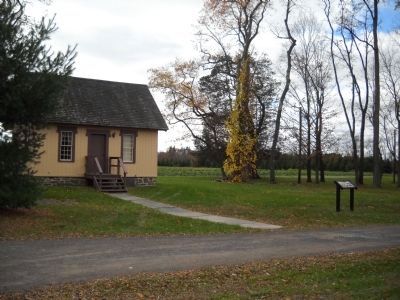
More about this marker. The background of the marker features a picture of the south meadow of Lindenwald, including the mansion, out buildings, fields and the two ponds. A picture of two field hands gathering apples appears at the lower left of the marker and has a caption of “The number of farmhands employed at Lindenwald varied according to the season and associated tasks. Planting occurred in the spring, cultivation filled the summer and harvesting took place in the autumn. Most farmhands lived in nearby communities with their families, but a few lived in buildings at Lindenwald. The south gatehouse, before you, housed farmhands as did its twin to the north.” The upper right of the marker contains a photo of a fishing lure and the caption “In the 1850’s, President Van Buren may have used fishing lures made by the J.T. Buel Company of Whitehall, NY. Photo courtesy of Collector Books, Schroeder Publishing Co.”
Also see . . .
1. Biography of Martin Van Buren. The White House website entry (Submitted on November 11, 2010, by Bill Coughlin of Woodland Park, New Jersey.)
2. Martin Van Buren National Historic Site. National Park Service website homepage (Submitted on November 11, 2010, by Bill Coughlin of Woodland Park, New Jersey.)
3. Van Buren, Martin, National Historic Site - National Park Service. Download National Register of Historic Places documentation (Submitted on January 17, 2024, by Anton Schwarzmueller of Wilson, New York.)
Credits. This page was last revised on January 17, 2024. It was originally submitted on November 11, 2010, by Bill Coughlin of Woodland Park, New Jersey. This page has been viewed 663 times since then and 16 times this year. Photos: 1. submitted on October 12, 2021, by Duane and Tracy Marsteller of Murfreesboro, Tennessee. 2, 3. submitted on November 11, 2010, by Bill Coughlin of Woodland Park, New Jersey. 4. submitted on October 12, 2021, by Duane and Tracy Marsteller of Murfreesboro, Tennessee.


