Near Darlington in Darlington County, South Carolina — The American South (South Atlantic)
Andrew Hunter
Side A
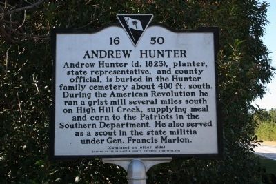
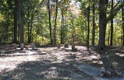
Andrew Hunter (d. 1823), planter, state representative, and county official, is buried in the Hunter family cemetery about 400 ft. south. During the American Revolution he ran a grist mill several miles south on High Hill Creek, supplying meal and corn to the Patriots in the Southern Department. He also served as a scout in the state militia under Gen. Francis Marion.
Side B
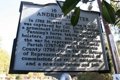
In 1782 Hunter, scouting in N.C., was captured by Col. David Fanning, a prominent Loyalist. He escaped on Fanning’s horse, taking his saddle, holsters, pistols, and papers. After the war he represented St. David’s Parish (1787-88) and Darlington County (1796-97) in the S.C. House of Representatives and served on commissions for roads, navigation, and a new courthouse and jail.
Erected 2002 by the Darlington County Historical Commission. (Marker Number 16-50.)
Topics. This historical marker is listed in this topic list: War, US Revolutionary. A significant historical year for this entry is 1782.
Location. 34° 15.615′ N, 79° 47.834′ W. Marker is near Darlington, South Carolina, in Darlington County. Marker is at the intersection of E. McIver Rd. and Pisgah Road, on the left when traveling north on E. McIver Rd.. Touch for map. Marker is in this post office area: Darlington SC 29532, United States of America. Touch for directions.
Other nearby markers. At least 8 other markers are within 5 miles of this marker, measured as the crow flies. Williamson's Bridge (approx. 0.9 miles away); Moses S. Haynsworth (approx. 1.4 miles away); Samuel Bacot 1745-1795 (approx. 1.6 miles away); Pleasant Grove Church (approx. 2.4 miles away); Attempted Ambush (approx. 3.2 miles away); Pisgah Methodist Church (approx. 4.2 miles away); Ebony Guest House (approx. 4.2 miles away); Darlington Memorial Cemetery (approx. 4.4 miles away). Touch for a list and map of all markers in Darlington.
Credits. This page was last revised on June 16, 2016. It was originally submitted on November 17, 2010, by David Bullard of Seneca, South Carolina. This page has been viewed 1,435 times since then and 77 times this year. Photos: 1, 2, 3. submitted on November 17, 2010, by David Bullard of Seneca, South Carolina. • Bill Pfingsten was the editor who published this page.


