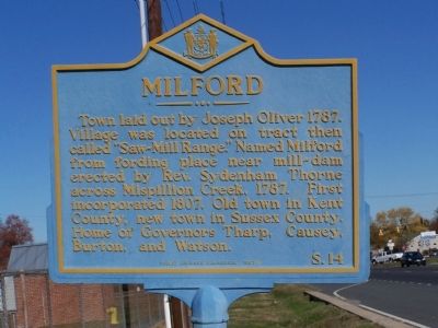
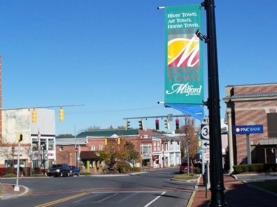
Milford in Sussex County, Delaware — The American Northeast (Mid-Atlantic)
Milford
Topics and series. This historical marker is listed in this topic list: Settlements & Settlers. In addition, it is included in the Delaware Public Archives series list. A significant historical year for this entry is 1787.
Location. 38° 54.001′ N, 75° 26.391′ W. Marker is in Milford, Delaware, in Sussex County. Marker is on Shawnee Road (U.S. 113) close to Shawnee Road (Delaware Route 36). Touch for map. Marker is at or near this postal address: 6493 Shawnee Road, Milford DE 19963, United States of America. Touch for directions.
Other nearby markers. At least 8 other markers are within one mile of this marker, measured as the crow flies. Milford's Struggle for Educational Equality (approx. 0.3 miles away); The Vaules-Grier Home (approx. 0.8 miles away); Temple Lodge No. 9 A.F. & A.M. (approx. 0.9 miles away); Mispillion River Greenway Historical Sites (approx. 0.9 miles away); a different marker also named Milford (approx. 0.9 miles away); Parson Thorne Mansion (approx. one mile away); Vale-Williams Memorial City Hall (approx. one mile away); a different marker also named Milford (approx. one mile away). Touch for a list and map of all markers in Milford.
Credits. This page was last revised on November 13, 2019. It was originally submitted on December 1, 2010, by Bill Pfingsten of Bel Air, Maryland. This page has been viewed 476 times since then and 24 times this year. Photos: 1, 2. submitted on December 1, 2010, by Bill Pfingsten of Bel Air, Maryland.

