Seymour in Jackson County, Indiana — The American Midwest (Great Lakes)
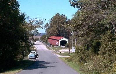
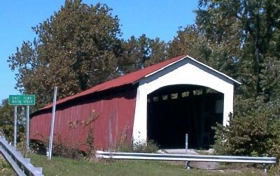
Shieldstown Bridge
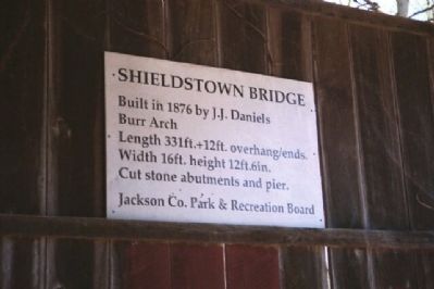
Built in 1876 by J.J. Daniels
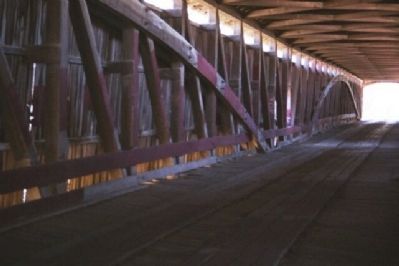
Burr Arch
Length 331 Ft. + 12 Ft. overhang/ends.
Width 16 ft. height 12ft.6in.
Cut stone abutments and pier.
Erected by Jackson Co. Park & Recreation Board.
Topics and series. This historical marker is listed in this topic list: Bridges & Viaducts. In addition, it is included in the Covered Bridges series list. A significant historical year for this entry is 1876.
Location. 38° 54.899′ N, 86° 0.164′ W. Marker is in Seymour, Indiana, in Jackson County. Marker is on East County Road 200 North. Follow East 200 North about 2 miles west from it's junction with US 50. This is south of Seymour. Touch for map. Marker is in this post office area: Seymour IN 47274, United States of America. Touch for directions.
Other nearby markers. At least 8 other markers are within 6 miles of this marker, measured as the crow flies. Sons Of The American Revolution Memorial (approx. 3.2 miles away); The Freedom Tree (approx. 3.3 miles away); Jackson County W.W. I Veterans Memorial (approx. 3.3 miles away); All Veterans Honor Roll Memorial (approx. 3.3 miles away); In Memory of Col. John Ketcham / Time Capsule (approx. 3.3 miles away); 10 O'Clock Indian Treaty Line (approx. 4.2 miles away); Indian Treaty Corner (approx. 4.2 miles away); B-25 Mitchell (approx. 5.2 miles away). Touch for a list and map of all markers in Seymour.
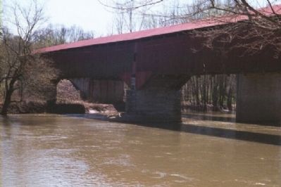
Regarding Shieldstown Bridge. The Shieldstown Covered Bridge crosses the East Fork of White River, in Section 32, Township 6 North, and Range 5 East, beside County Road 250 East, northeast of Brownstown, Jackson County. This double span Burr Arch Truss structure has a length of 331 feet, or 355 feet including the 12-foot overhang at each end, with a portal clearance 16 feet wide by 12 feet 6 inches high. Built in 1876 by Joseph J. Daniels, the road bypassed this structure after 1977. This bridge was listed as #14-36-02 in the 1989 World Guide.
This bridge is not on the National Register of Historic Places. Only the Bell Ford Bridge and the Medora Covered Bridge are listed on the National Register. Bell Ford Bridge totally collapsed and was abandoned.
Source: Fleeta K. Arthur, primary bridge researcher for Jackson County covered bridges and member of the Jackson County Park and Recreation Board.
Also see . . . Indiana Covered Bridge Society (ICBS). (Submitted on March 22, 2008, by Craig Swain of Leesburg, Virginia.)
Photographed By Christopher Light, November 19, 2006
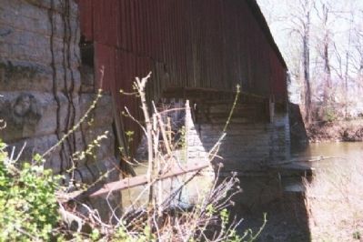
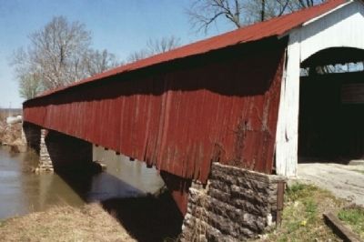
5. 12 Ft Overhang On The East Side
The overhang is the portion of the bridge work that sits atop the approach abutment. It does not actually appear to hang out from the bridge, as it is also sided and forms the entry. It is the portion of the bridge that does not rest on the stringers that span the gap between abutments and piers.
Credits. This page was last revised on January 4, 2020. It was originally submitted on March 21, 2008, by Christopher Light of Valparaiso, Indiana. This page has been viewed 1,849 times since then and 21 times this year. Last updated on December 28, 2010, by Fleeta K. Arthur of Brownstown, Indiana. Photos: 1, 2, 3, 4, 5. submitted on March 21, 2008, by Christopher Light of Valparaiso, Indiana. 6, 7. submitted on November 14, 2008, by David Seibert of Sandy Springs, Georgia. • Kevin W. was the editor who published this page.
