Isle Of Palms in Charleston County, South Carolina — The American South (South Atlantic)
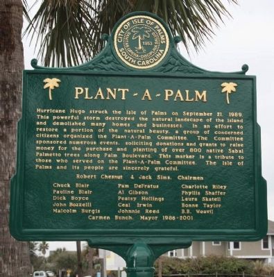
Plant - a - Palm
Chuck Blair•Pam DeFratus•Charolette Riley• Pauline Blair•Al Gibson•Phyllis Shaffer• Dick Boyce•Peatsy Hollings•Laura Skatell• John Bozzelli•Ceal Irwin•Bonne Taylor• Malcom Burgis•Johnnie Reed•B.B. Weavil
Carmen Bunch, Mayor 1986-2001
Erected by City of Isle of Palms South Carolina.
Topics. This historical marker is listed in these topic lists: Charity & Public Work • Disasters • Horticulture & Forestry. A significant historical month for this entry is September 1791.
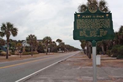
Location. 32° 47.341′ N, 79° 46.957′ W. Marker is in Isle Of Palms, South Carolina, in Charleston County. Marker is on Palm Blvd. (State Highway 703) near 22nd Avenue, on the right when traveling north. Touch for map. Marker is at or near this postal address: 2104 Palm Blvd, Isle of Palms SC 29451, United States of America. Touch for directions.
Other nearby markers. At least 8 other markers are within 2 miles of this marker, measured as the crow flies. Lord Cornwallis (approx. 1.7 miles away); British Attack at Breach Inlet / Battery Marshall (approx. 2.1 miles away); Breach Inlet / Military History (approx. 2.1 miles away); Victory at Breach Inlet (approx. 2.1 miles away); Battle of Sullivan’s Island (approx. 2.1 miles away); Charles Town in the American Revolution (approx. 2.1 miles away); Liberty or Death (approx. 2.1 miles away); Thomson Park (approx. 2.1 miles away).
Regarding Plant - a - Palm. The area in and around Charleston, South Carolina suffered mostly from wind damage. Sullivan's Island and the Isle of Palms were cut off from the mainland by the storm's destruction of the Ben Sawyer Bridge.
Related marker. Click here for another marker that is related to this marker. More about Hurricane Hugo
Also see . . . Hurricane Hugo. a destructive Category 5 hurricane that struck Guadeloupe, Montserrat, St. Croix, Puerto Rico, Antigua and South Carolina in September of the 1989 Atlantic hurricane season. (Submitted on January 18, 2011, by Mike Stroud of Bluffton, South Carolina.)
Credits. This page was last revised on June 16, 2016. It was originally submitted on January 18, 2011, by Mike Stroud of Bluffton, South Carolina. This page has been viewed 1,305 times since then and 64 times this year. Photos: 1, 2. submitted on January 18, 2011, by Mike Stroud of Bluffton, South Carolina.

