Marker Logo HMdb.org THE HISTORICAL
MARKER DATABASE
“Bite-Size Bits of Local, National, and Global History”
Adel in Cook County, Georgia — The American South (South Atlantic)
 

Cook County


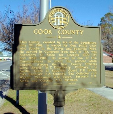
Cook County Marker image. Click for full size.
Photographed By David Seibert, January 23, 2011
1. Cook County Marker
Inscription. This County, created by Act of the Legislature July 30, 1918, is named for Gen. Philip Cook who fought in the States and Seminole Wars. He served in Congress from 1872 to '82, was Secretary of State for Georgia 1890-94 and 1898-1918. He served as one of five Commissioners to erect the present State Capitol. Among the first County Officers were: Sheriff W. T. Dougherty, Ordinary C. O. Smith, Clerk of Superior Court F. R. Booth, Tax Receiver J. A. Kinnard, Tax Collector J. B. Wright, Treasurer W. M. Tyson, Surveyor E. R. Slade and Coroner A. D. Wiseman.
 
Erected 1954 by Georgia Historical Commission. (Marker Number 037-1.)
 
Topics and series. This historical marker is listed in this topic list: Political Subdivisions. In addition, it is included in the Georgia Historical Society series list. A significant historical date for this entry is July 30, 1900.
 
Location. 31° 8.353′ N, 83° 25.444′ W. Marker is in Adel, Georgia, in Cook County. Marker is on North Hutchinson Avenue (U.S. 41) 0 miles south of West 2nd Street, on the right when traveling south. The marker stands in front of the Cook County Courthouse. Touch for map. Marker is at or near this postal address: 212 North Hutchinson Avenue, Adel GA 31620, United States of America. Touch for directions.
 
Other nearby markers. At least 8 other markers are within 8 miles of this marker, measured as the crow flies. Cook County Tornado of 2017 (a few steps
Paid Advertisement
Click on the ad for more information.
Please report objectionable advertising to the Editor.
Click or scan to see
this page online
from this marker); Cook County Veterans Memorial (within shouting distance of this marker); Cook County Courthouse (within shouting distance of this marker); Old United States Post Office, Adel, Georgia (about 800 feet away, measured in a direct line); SOWEGA Building (approx. 0.2 miles away); Adel Lime Sink (approx. ¼ mile away); Old Coffee Road (approx. 6½ miles away); Reed Bingham State Park Bridge (approx. 7.1 miles away). Touch for a list and map of all markers in Adel.
 
Cook County Marker image. Click for full size.
Photographed By David Seibert, January 23, 2011
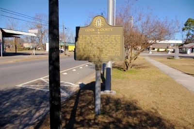
2. Cook County Marker
Looking north on North Hutchinson Avenue
Cook County Marker image. Click for full size.
Photographed By David Seibert, January 23, 2011
3. Cook County Marker
The marker in front of the Cook County Courthouse
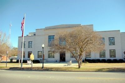
Cook County Courthouse image. Click for full size.
Photographed By David Seibert, January 23, 2011
4. Cook County Courthouse
Cook County's first purpose-built courthouse was erected in 1939.
 
 
Credits. This page was last revised on June 16, 2016. It was originally submitted on February 21, 2011, by David Seibert of Sandy Springs, Georgia. This page has been viewed 775 times since then and 17 times this year. Photos:   1, 2, 3, 4. submitted on February 21, 2011, by David Seibert of Sandy Springs, Georgia. • Bill Pfingsten was the editor who published this page.
Share this page.  
Share on Tumblr
m=40446

CeraNet Cloud Computing sponsors the Historical Marker Database.
This website earns income from purchases you make after using our links to Amazon.com. We appreciate your support.
Paid Advertisements
Mar. 19, 2024