Del Rio in Cocke County, Tennessee — The American South (East South Central)
Tennessee / North Carolina
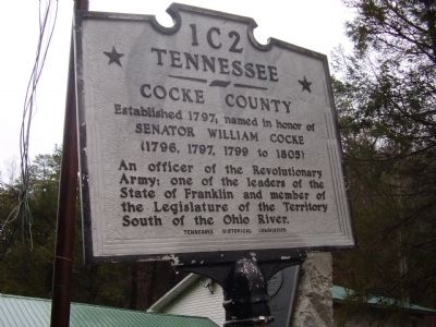
Tennessee
Cocke County
Established 1797, named in honor of Senator William Cocke (1796, 1797, 1799 to 1805)
An officer of the Revolutionary Army; one of the leaders of the State of Franklin and member of the Legislature of the Territory South of the Ohio River.
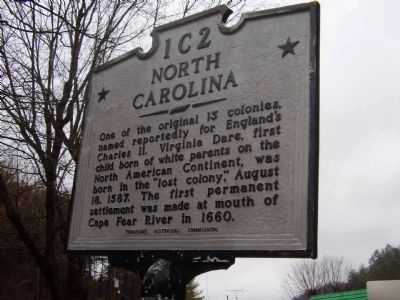
Reverse:
North Carolina
One of the original 13 colonies, named reportedly for England's Charles II. Virginia Dare, first child born of white parents on the North American Continent, was born in the "lost colony", August 18, 1587. The first permanent settlement was made at mouth of Cape Fear River in 1660.
Erected by Tennessee Historical Commission. (Marker Number 1C 2.)
Topics and series. This historical marker is listed in this topic list: Settlements & Settlers. In addition, it is included in the Tennessee Historical Commission series list. A significant historical year for this entry is 1797.
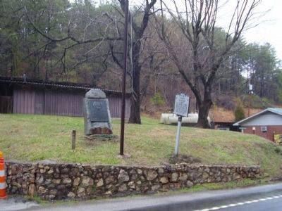
Location. 35° 55.073′ N, 82° 54.762′ W. Marker is in Del Rio, Tennessee, in Cocke County. Marker is on Dixie Highway (U.S. 25) 0.4 miles west of Paint Rock Road, on the right when traveling west. Touch for map. Marker is at or near this postal address: 4887 Dixie Highway, Del Rio TN 37727, United States of America. Touch for directions.
Other nearby markers. At least 8 other markers are within 6 miles of this marker, measured as the crow flies. Robert E. Lee (within shouting distance of this marker in North Carolina); Balladry (approx. 5 miles away in North Carolina); Dorland - Bell Institute (approx. 5 miles away in North Carolina); Old Red Bridge (approx. 5.1 miles away in North Carolina); Hot Springs (approx. 5.1 miles away in North Carolina); Warm Springs Hotel (approx. 5.1 miles away in North Carolina); a different marker also named Hot Springs (approx. 5.2 miles away in North Carolina); Grace Moore (approx. 5.3 miles away).
Credits. This page was last revised on July 23, 2021. It was originally submitted on March 6, 2011, by Stanley and Terrie Howard of Greer, South Carolina. This page has been viewed 830 times since then and 13 times this year. Photos: 1, 2, 3. submitted on March 6, 2011, by Stanley and Terrie Howard of Greer, South Carolina. • Bernard Fisher was the editor who published this page.


