Fort George in Manhattan in New York County, New York — The American Northeast (Mid-Atlantic)
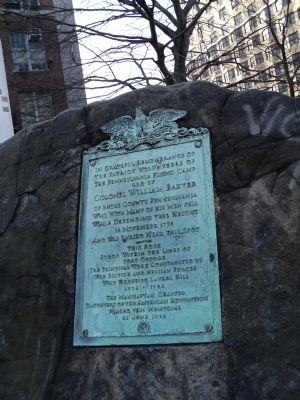
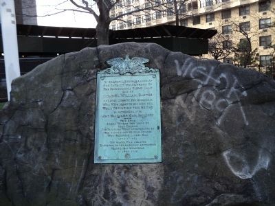
Colonel William Baxter
the patriot volunteers of
the Pennsylvania Flying Camp
led by
Colonel William Baxter
of Bucks County, Pennsylvania
who with many of his men fell
while defending this height
16 November 1776
and was buried near this spot.
----------
This rock
stood within the lines of
Fort George
the principal work constructed by
the British and Hessian forces
who occupied Laurel Hill
1776 – 1783
The Manhattan Chapter
Daughters of the American Revolution
placed this memorial
23 June 1923
Erected 1923 by Daughters of the American Revolution - Manhattan Chapter.
Topics and series. This historical marker is listed in this topic list: War, US Revolutionary. In addition, it is included in the Daughters of the American Revolution series list. A significant historical date for this entry is June 23, 1923.
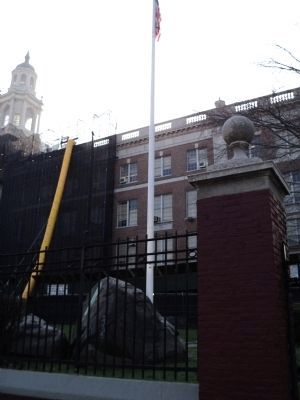
Location. 40° 51.331′ N, 73° 55.628′ W. Marker is in Manhattan, New York, in New York County. It is in Fort George. Marker is at the intersection of Audubon Avenue and 192nd Street, on the right when traveling north on Audubon Avenue. Marker is located at the base of the flagpole in front of George Washington High School. Touch for map. Marker is in this post office area: New York NY 10040, United States of America. Touch for directions.
Other nearby markers. At least 8 other markers are within walking distance of this marker. Margaret Cochran Corbin (approx. 0.4 miles away); Fort Tryon (approx. half a mile away); Fort Tryon Park (approx. half a mile away); McNally Plaza World War I Memorial (approx. half a mile away); Fort Washington (approx. 0.6 miles away); Highest Point on Manhattan (approx. 0.6 miles away); Robert Magaw Defended this Position (approx. 0.6 miles away); Plaza Lafayette (approx. 0.8 miles away). Touch for a list and map of all markers in Manhattan.
Also see . . .
1. The Battle of Fort Washington, November 16, 1776 at Fort Washington, New York. The American Revolutionary War website. (Submitted on April 10, 2011, by Bill Coughlin of Woodland Park, New Jersey.)
2. Battle for Fort Washington. Sons of the South entry (Submitted on April 10, 2011, by Bill Coughlin of Woodland Park, New Jersey.)
3. The Battle of Fort Washington. A British perspective of the battle from BritishBattles.com. (Submitted on April 10, 2011, by Bill Coughlin of Woodland Park, New Jersey.)
Credits. This page was last revised on January 31, 2023. It was originally submitted on April 10, 2011, by Bill Coughlin of Woodland Park, New Jersey. This page has been viewed 1,816 times since then and 46 times this year. Photos: 1, 2, 3. submitted on April 10, 2011, by Bill Coughlin of Woodland Park, New Jersey.


