Cohasset in Norfolk County, Massachusetts — The American Northeast (New England)
Antoine and Wilson Memorial
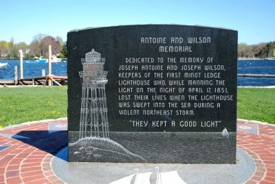
Dedicated to the memory of Joseph Antoine and Joseph Wilson, keepers of the first Minot Ledge Lighthouse who, while manning the Light on the night of Apr. 17, 1851, lost their lives when the lighthouse was swept into the sea during a violent northeast storm.
Erected 2000.
Topics and series. This historical marker and memorial is listed in this topic list: Notable Places. In addition, it is included in the Lighthouses series list. A significant historical date for this entry is April 17, 1967.
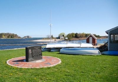
Location. 42° 14.33′ N, 70° 47.33′ W. Marker is in Cohasset, Massachusetts, in Norfolk County. Marker can be reached from Government Island Road, 0.1 miles north of Border Street, on the left when traveling north. Marker is on Government Island (now a peninsula). Marker is accessible when leaving Cohasset center by traveling east on Border Street. Immediately after crossing the bridge, turn left. Touch for map. Marker is at or near this postal address: 92 Border Street, Cohasset MA 02025, United States of America. Touch for directions.
Other nearby markers. At least 8 other markers are within 4 miles of this marker, measured as the crow flies. Minot's Ledge Lighthouse (a few steps from this marker); Mordecai Lincoln Mill and Homestead (approx. 1.1 miles away); Early Boundary Line (approx. 1.1 miles away); Gannettís Corner (approx. 1.4 miles away); Lawson Tower (approx. 3.2 miles away); Cudworth House (approx. 3.2 miles away); Hull (approx. 3Ĺ miles away); Williams-Barker House (approx. 4 miles away).
Regarding Antoine and Wilson Memorial. Roughly two miles offshore from the Massachusetts towns of Cohasset and North Scituate sits Minotís Ledge, a normally submerged hazard well-known to mariners since Capt. John Smith had a close call there in 1614.
Following a sharp increase in shipwrecks early in the 19th century, mariners clamored for a lighthouse to be erected on or near that ledge. A thorough assessment was conducted in 1847 by Capt. William H. Swift, United States Engineers, who strongly opposed a stone tower. Instead, he favored an iron-pile structure that would present much less resistance to powerful waves in a storm. In supervising the actual construction, Smith sank his iron pilings five feet into the ledge and extended them 50 feet above the water. Atop these “stilts” he perched a storeroom, keeperís quarters, and lantern room, so that the overall height became 75 feet.
Sadly, on October 6, 1849, less than three months

Photographed By Roger W. Sinnott, May 1, 2011
2. The View from Government Island
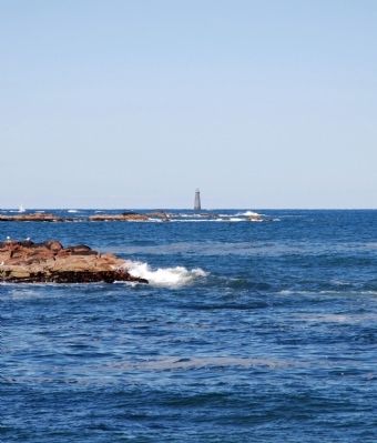
Beyond the marker is the mouth of Cohasset harbor and the open Atlantic Ocean. Both the original and the present Minotís Ledge Lighthouses were constructed 2.6 miles out from here, at a point blocked in this view by Wood Island and Scituate Neck at right.
According to the log of keeper Isaac Dunham, the light was lit for the first time on January 1, 1850. But within weeks Dunham began to have serious misgivings about the structureís safety. For example, on April 6, 1850, he wrote, “The wind E. blowing hard with an ugly sea which makes the Light House real like a Drunken Man = I hope God will in mercy still the raging sea = or we must perish.” By October of that year, completely unnerved, Dunham quit.
The next keeper, John W. Bennett, initially scoffed at his predecessorís fearfulness. Then in December he, too, petitioned to have the structure reinforced. Yet as late as January 9, 1851, engineer Smith wrote a long newspaper article explaining why the lighthouse could not possibly fall over.
In mid-April 1851, a major noríeaster descended on the New England coast. Flood waters undermined railway beds south of Boston, and the city itself briefly became an island. In its April 16th afternoon edition, the Boston Evening Transcript wrote, “Great apprehensions are felt in regard to the lighthouse at Minotís Ledge. The weather is still too misty

Photographed By Roger W. Sinnott, April 28, 2011
3. First Minotís Light
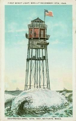
Perched on 10-inch-diameter iron columns, the short-lived first lighthouse on Minotís Ledge is imagined in this postcard rendition from about 1925. (The card gives an erroneous date for when the lamp was officially lit; perhaps it refers to a test.)
As late as 10 p.m., Cohasset residents could still glimpse the lighthouseís beacon, and around 1 a.m. they could hear its bell being rung. But the light of dawn revealed the awful truth: The lighthouse was gone. The body of Antoine later washed ashore at Nantasket, several miles north of Cohasset. Wilson apparently managed to swim to Gull Rock, which is somewhat closer to shore than Minotís Ledge, where he too died.
In the years immediately following this tragedy, a lightship was temporarily anchored at Minotís Ledge as plans were made for a much more massive structure to be built (see the link, above, to the adjacent marker).
[The above summary is based on Edward Rowe Snowís classic, The Story of Minotís Light (Halliday, 1940, 1955).]
Also see . . . Minot's Ledge Light. Wikipedia entry (Submitted on May 2, 2011, by Roger W. Sinnott of Chelmsford, Massachusetts.)
Credits. This page was last revised on April 11, 2021. It was originally submitted on May 1, 2011, by Roger W. Sinnott of Chelmsford, Massachusetts. This page has been viewed 1,203 times since then and 46 times this year. It was the Marker of the Week April 11, 2021. Photos: 1, 2, 3, 4. submitted on May 1, 2011, by Roger W. Sinnott of Chelmsford, Massachusetts. • Bernard Fisher was the editor who published this page.

