Chippewa Falls in Chippewa County, Wisconsin — The American Midwest (Great Lakes)
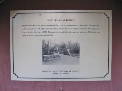
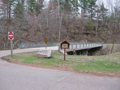
Bear Den Road Bridge
Marker Sign #49
Erected by Chippewa County Historical Society. (Marker Number 49.)
Topics. This historical marker is listed in this topic list: Bridges & Viaducts. A significant historical year for this entry is 1940.
Location. 44° 57.256′ N, 91° 23.87′ W. Marker is in Chippewa Falls, Wisconsin, in Chippewa County. Marker is at the intersection of Irvine Park Drive and Bear Den Drive, on the right when traveling north on Irvine Park Drive. Marker is in Irvine Park. Touch for map. Marker is in this post office area: Chippewa Falls WI 54729, United States of America. Touch for directions.
Other nearby markers. At least 8 other markers are within walking distance of this marker. Sunny Valley School (approx. ¼ mile away); Pioneer Norwegian Log Home (approx. ¼ mile away); William Irvine (approx. 0.4 miles away); In Memory of Old Abe (approx. 0.4 miles away); Irvine Park Drive Bridge (approx. half a mile away); The Chippewa Valley Electric Railway Co. (approx. half a mile away); Northern Wisconsin State Fair (approx. half a mile away); The Jacob Leinenkugel Brewing Company (approx. 0.7 miles away). Touch for a list and map of all markers in Chippewa Falls.
Credits. This page was last revised on June 16, 2016. It was originally submitted on June 3, 2011, by Keith L of Wisconsin Rapids, Wisconsin. This page has been viewed 855 times since then and 16 times this year. Photos: 1, 2, 3. submitted on June 3, 2011, by Keith L of Wisconsin Rapids, Wisconsin.


