East Portal in Mineral County, Montana — The American West (Mountains)
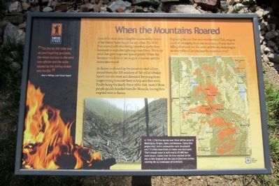
When the Mountains Roared
“The fire by this time was an awe-inspiring spectacle, the whole horizon to the west was aflame and the noise caused by the falling timber was terrific.” - Roy A. Phillips, Lolo Forest Guard
One of the most devastating fire seasons in the history of the United States began like any other. The 1910 Fires started with smoldering campfires, sparks from locomotives and a few lightning-caused fires. The many small fires grew larger and spread quickly. When the ferocious winds hit in late August, witnesses said the mountains roared.
As flames swallowed up the mountains and valleys around them, the 200 residents of Taft rolled whiskey barrels into the street and dismissed the young forest rangers trying to recruit them to help save their town. Finally facing the deadly threat of the fires, most of these people quickly boarded trains for Missoula, leaving their emptied town in flames.
Exploring the area that once was the site of Taft, imagine a wall of fire raging down the mountain, ash and cinders falling all around you like snow and the sky darkening to an eerie yellow. Can you hear the mountains roar?
Erected 2010 by Lolo National Forest.
Topics. This historical marker is listed in this topic list: Disasters. A significant historical year for this entry is 1910.
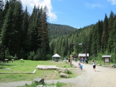
Location. 47° 23.785′ N, 115° 38.096′ W. Marker is in East Portal, Montana, in Mineral County. Marker can be reached from Rainy Creek Road (Federal Road 506) 2 miles south of Exit 5 (Taft) (Interstate 90). Located at the Route of the Hiawatha Trailhead. Touch for map. Marker is in this post office area: Saltese MT 59867, United States of America. Touch for directions.
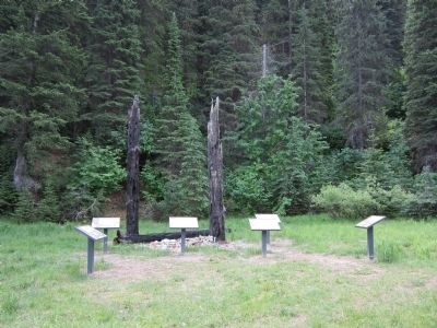
Other nearby markers. At least 8 other markers are within walking distance of this marker. A Battle That Could Not Be Won (here, next to this marker); An Unlikely Safe Haven (a few steps from this marker); Building From the Ashes (a few steps from this marker); Pluck and Good Fortune (a few steps from this marker); Douse the Flames and Climb Aboard (a few steps from this marker); Life Along the Line (a few steps from this marker); Substation 13 (within shouting distance of this marker); The Route of the Hiawatha (within shouting distance of this marker). Touch for a list and map of all markers in East Portal.
More about this marker. On the bottom are a map & photo with the caption, "In 1910, 1,736 fires burned over three million acres in Washington, Oregon, Idaho and Montana. Eighty-five people died, entire communities were devastated and 7.5 billion board-feet of timber was destroyed. That’s enough wood to build nearly 55,000 four-room houses. Smoke from the fires reached all the way to New England and the soot drifted even further, covering the icy landscapes of Greenland."
photo: Forest Service Northern Region Archives
map: Idaho Panhandle National Forest
Also see . . . 1910 Fire Commemoration Information Site. US Forest Service (Submitted on August 3, 2011, by Bernard Fisher of Richmond, Virginia.)
Credits. This page was last revised on October 15, 2020. It was originally submitted on August 3, 2011, by Bernard Fisher of Richmond, Virginia. This page has been viewed 634 times since then and 17 times this year. Photos: 1, 2, 3. submitted on August 3, 2011, by Bernard Fisher of Richmond, Virginia.


