Cascade near Colorado Springs in El Paso County, Colorado — The American Mountains (Southwest)
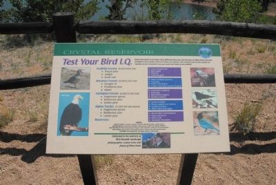
Test Your Bird I.Q.
Foothills Forest (6,000-8,000 feet): Pinyon pine, Juniper, Scrub oak.
Montane Forests (8,000-9,500 feet) Douglas fir, Ponderosa pine, Aspen.
Subalpine Forests (9,500-11,500 feet) Englemann spruce, Bristlecone pine, Limber pine.
Alpine Tundra (11,500 feet and above) Englemann spruce, Bristlecone pine, Limber pine.
Reservoirs. Green-winged teals, Bald eagles, Mallards, California gulls, White-crowned sparrows, Gray jays, Clark’s nutcrackers, Golden and ruby-crowned kinglets, Twonsend’s solitaires, Scrub jays, Black-billed magpies, Spotted towhees, American pipits, Brown-capped rosy finches, Common ravens, White-tailed ptarmigan, Broad-tailed hummingbirds, Dark-eyed junco, Steller’s jay, Mountain chickadees.
Dedicated to the memory of Rich Buzzelli, landscape photographer, nature lover and friend of Pikes Peak.
Topics. This historical marker is listed in this topic list: Animals.
Location. 38° 55.301′ N, 105° 1.549′ W. Marker is near Colorado Springs, Colorado, in El Paso County. It is in Cascade. Marker is on Pike's Peak Toll Road. Marker is found at the Crystal Reservoir Visitor Center. Touch for map. Marker is in this post office area: Cascade CO 80809, United States of America. Touch for directions.
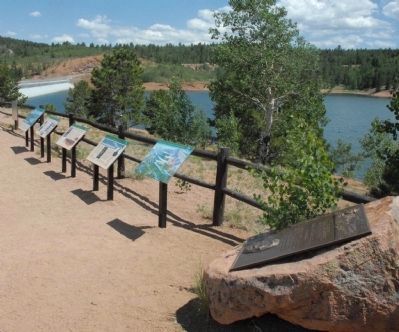
Other nearby markers. At least 8 other markers are within 3 miles of this marker, measured as the crow flies. Well-traveled Water (here, next to this marker); The Making of America's Mountain (here, next to this marker); A Mountain of Many Names (here, next to this marker); Take a Closer Look...Foothills Life Zone (here, next to this marker); Take a Closer Look...Montane Life Zone (here, next to this marker); Take a Closer Look...Alpine/Subalpine Life Zone (here, next to this marker); Pick a Climate (here, next to this marker); Welcome to America’s Mountain (approx. 2.4 miles away). Touch for a list and map of all markers in Colorado Springs.
Credits. This page was last revised on February 7, 2023. It was originally submitted on August 10, 2011, by Charles T. Harrell of Woodford, Virginia. This page has been viewed 681 times since then and 9 times this year. Photos: 1, 2. submitted on August 10, 2011, by Charles T. Harrell of Woodford, Virginia. • Bill Pfingsten was the editor who published this page.

