Marker Logo HMdb.org THE HISTORICAL
MARKER DATABASE
“Bite-Size Bits of Local, National, and Global History”
Gentilly in New Orleans in Orleans Parish, Louisiana — The American South (West South Central)
 

London Avenue Canal Floodwall Breach


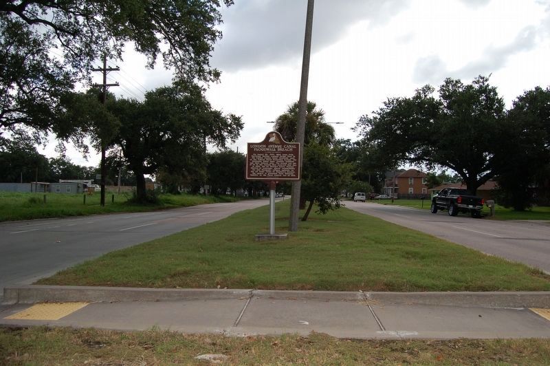
London Avenue Canal Floodwall Breach Marker image. Click for full size.
circa June 20, 2011
1. London Avenue Canal Floodwall Breach Marker
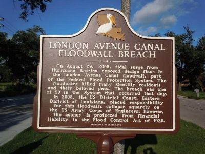
Inscription. On August 29, 2005, tidal surge from Hurricane Katrina exposed design flaws in the London Avenue Canal floodwall, part of the Federal Flood Protection System. The floodwater killed many Gentilly residents and their beloved pets. The breach was one of 50 in the System that occurred that day.

In 2008, the US District Court, Eastern District of Louisiana, placed responsibility for this floodwall's collapse squarely on the US Army Corps of Engineers; however, the agency is protected from financial liability in the Flood Control Act of 1928.
 
Erected 2011 by Levees.Org.
 
Topics. This historical marker is listed in this topic list: Disasters. A significant historical year for this entry is 2005.
 
Location. 30° 0.456′ N, 90° 4.118′ W. Marker is in New Orleans, Louisiana, in Orleans Parish. It is in Gentilly. Marker is at the intersection of Warrington Drive and Maribeau Ave., in the median on Warrington Drive. Touch for map. Marker is at or near this postal address: 4902 Warrington Drive, New Orleans LA 70122, United States of America. Touch for directions.
 
Other nearby markers. At least 8 other markers are within 2 miles of this marker, measured as the crow flies. Brothers Of The Sacred Heart (approx. 0.6 miles away); Fort St. John (approx. 1.4 miles away); Centennial (approx. 1˝ miles away); Pontchartrain Park Historic District (approx.

Paid Advertisement
Click on the ad for more information.
Please report objectionable advertising to the Editor.
Click or scan to see
this page online
1.7 miles away); Fair Grounds Race Course (approx. 1.7 miles away); Fannie C. Williams / Valena C. Jones Elementary School (approx. 2 miles away); The Croatian Benevolent Association of Louisiana (approx. 2.1 miles away); In Memory of All American Veterans (approx. 2.1 miles away). Touch for a list and map of all markers in New Orleans.
 
Additional keywords. Engineering disasters, man-made disasters
 
London Avenue Canal Floodwall Breach Marker image. Click for full size.
September 3, 2016
2. London Avenue Canal Floodwall Breach Marker
 
 
Credits. This page was last revised on February 12, 2023. It was originally submitted on August 9, 2011, by A. Jayne Avery of New Orleans, Louisiana. This page has been viewed 1,723 times since then and 114 times this year. Last updated on August 13, 2011, by Sandy Rosenthal of New Orleans, Louisiana. Photos:   1. submitted on August 9, 2011.   2. submitted on September 4, 2016. • Bill Pfingsten was the editor who published this page.
Share this page.  
Share on Tumblr
m=46064

CeraNet Cloud Computing sponsors the Historical Marker Database.
This website earns income from purchases you make after using our links to Amazon.com. We appreciate your support.
Paid Advertisement
Apr. 26, 2024