College Hill in Lynchburg, Virginia — The American South (Mid-Atlantic)
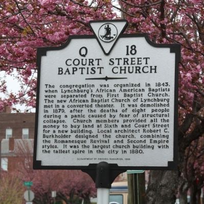
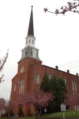
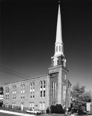
Court Street Baptist Church
Erected 1998 by Department of Historic Resources. (Marker Number Q-18.)
Topics and series. This historical marker is listed in these topic lists: African Americans • Churches & Religion. In addition, it is included in the Virginia Department of Historic Resources (DHR) series list. A significant historical year for this entry is 1843.
Location. 37° 24.992′ N, 79° 8.798′ W. Marker is in Lynchburg, Virginia. It is in College Hill. Marker is on Court Street south of 5th Street (Virginia Route 163), on the right when traveling south. (Until recently, 5th Street was U.S. Business Route 29.). Touch for map. Marker is in this post office area: Lynchburg VA 24504, United States of America. Touch for directions.
Other nearby markers. At least 8 other markers are within walking distance of this marker. Elizabeth Langhorne Lewis (within shouting distance of this marker); Carter Glass House (about 400 feet away, measured in a direct line); Abram Frederick Biggers and Biggers School (about 500 feet away); Rosalie Slaughter Morton, M.D. (1872-1968) (about 500 feet away); Latham's Battery (about 500 feet away); St. Paul's Vestry House (about 500 feet away); The Academy of Music (1905-1958) (about 700 feet away); The Ladies Relief Hospital (about 700 feet away). Touch for a list and map of all markers in Lynchburg.
Related marker. Click here for another marker that is related to this marker.
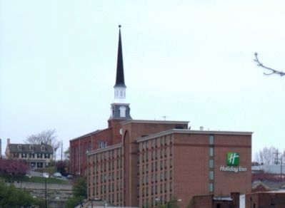
Also see . . . Court Street Baptist Church - 1982 National Register of Historic Places Nomination Form. Prepared by S. Allen Chambers. “Court Street Baptist Church is Lynchburg’s chief black architectural landmark. Begun in 1879 and completed in 1880, it was then the largest church edifice in the city, with its spire the tallest object on the downtown skyline. The church was designed by a local white architect, R. C. Burkholder, but black labor was used exclusively in its construction, and black artisans were in large part responsible for the decorations and furnishings of the auditorium. Although a number of nearby residents initially objected to the building of a black church on what was then one of Lynchburg’s most fashionable residential
streets,
as construction progressed the white community began to applaud the congregation for its
accomplishment. When the church was completed, the editor of the Daily Virginian spoke
for all in declaring that ‘it stands an almost imperishable monument to the vigor, enterprise
and religious zeal of the society to which it belongs’. . . .
“Behind the short notice that the lot was purchased by a [black] citizen lay another story, one amplified by a historical sketch published by the church in 1960: ‘At that time, Court Street was where the homes of the prominent and rich white residents lived, and during the days of slavery they wanted to keep the Negro slaves near them in their worship services in order to observe their loyalty. However, when Freedom came, they had no further interest in them, and they wanted to force the Negroes to move their worship place from the prominent Court Street residential section of the city. But, since Negroes had worshipped on that street since it was the center of the town, the colored congregation was just as determined to remain on Court Street with the Church.’
“When it was learned that the black congregation intended to purchase a lot near the site of the old building, the owner was offered a substantially larger amount by several whites to prevent the sale. This attempt failed, however, for the trustees had
placed a
deposit of $100 on the lot and had entered into a binding agreement to pay the balance of
$2,400 within a certain amount of time. Pressure then was put on the city’s banks and loan associations to refuse a loan to the congregation, but this ploy was thwarted when the church
members gathered their savings together and contributed enough to cover not only the purchase
price of the lot, but also several thousand dollars in construction costs for the actual
building. That the congregation could come up with such an amount on short notice is explained
in the church history by the racial tension that prevailed in Lynchburg in the postbellum
era: ‘At a time when colored people did not trust the white people too much,
most of the members of the church had their savings at home between
mattresses, or wrapped in socks, and small bags stuck in the attic,
or in cavities over the mantles’.” (Submitted on August 28, 2011.)
Credits. This page was last revised on February 1, 2023. It was originally submitted on August 28, 2011, by J. J. Prats of Powell, Ohio. This page has been viewed 1,338 times since then and 44 times this year. It was the Marker of the Week September 4, 2011. Photos: 1, 2, 3, 4. submitted on August 28, 2011, by J. J. Prats of Powell, Ohio.


