Searsport in Waldo County, Maine — The American Northeast (New England)
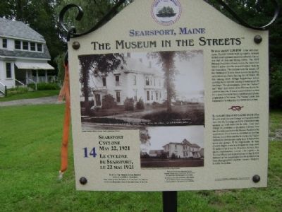
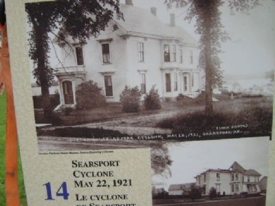
Searsport Cyclone May 22, 1921 / Le Cyclone de Searsport, le 22 mai 1921
Searsport, Maine
— The Museum in the Streets —
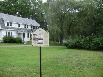
It was about 1:30 PM - a hot still afternoon. Thunder clouds built up rapidly. A black funnel cloud appeared northwest of town. The air was full of dust and flying debris. The 1859 Phineas Pendleton House across the street was lifted 8 inches into the air and dropped back on the foundation. The cyclone took the steeple off the Methodist Church, threw a cow into the bay and picked up a barn, leaving the car inside. All this among other strange happenings before moving out to sea and causing a water spout 50 feet high. The photographs show the "before" and "after" destruction of the Havener house located on this site. It was a common local custom for a proud owner to have a professional photograph taken of his home. The "before" photo just happened to be taken the day before the cyclone.
Erected 2009 by The Museum in the Streets®. (Marker Number 14.)
Topics and series. This historical marker is listed in this topic list: Disasters. In addition, it is included in the The Museum in the Streets®: Searsport, Maine series list. A significant historical year for this entry is 1859.
Location. 44° 27.27′ N, 68° 55.911′ W. Marker is in Searsport, Maine, in Waldo County. Marker is on West Main Street (Rt. US-1) south of Prospect Street, on the right when traveling north. Touch for map. Marker is in this post office area: Searsport ME 04974, United States of America. Touch for directions.
Other nearby markers. At least 8 other markers are within walking distance of this marker. Home of Clara Pendleton Blanchard 1843-1931 / La maison de Clara Pendleton Blanchard 1843-1931 (about 700 feet away, measured in a direct line); The Site of a Lumber Mill 1890 / Site d'une scierie, 1890 (approx. ¼ mile away); Searsport House (approx. 0.3 miles away); Raising the Flag / Hisser le drapeau (approx. 0.4 miles away); Early Banking / Les premières banques (approx. 0.4 miles away); Peter Ward, Ship Carpenter: Living and Working in a Neighborhood of Artisans (approx. 0.4 miles away); Union School (approx. 0.4 miles away); Making a Living / Gagner sa vie (approx. 0.4 miles away). Touch for a list and map of all markers in Searsport.
More about this marker. Marker #14 (of 17) in "The Museum in the Streets". The text on the Marker is in English, followed by a French translation.
Credits. This page was last revised on December 3, 2021. It was originally submitted on August 30, 2011, by James True of Newark, New Jersey. This page has been viewed 687 times since then and 18 times this year. Photos: 1, 2, 3. submitted on August 30, 2011, by James True of Newark, New Jersey. • Bill Pfingsten was the editor who published this page.
Editor’s want-list for this marker. Transcription of the French text • Can you help?


