Rockdale in Dane County, Wisconsin — The American Midwest (Great Lakes)
Rockdale Mill
Inscription.
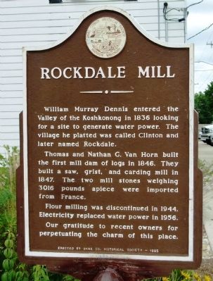
William Murray Dennis entered the Valley of the Koshkonong in 1836 looking for a site to generate water power. The village he platted was called Clinton and later named Rockdale.
Thomas and Nathan G. Van Horn built the first mill dam of logs in 1846. They built a saw, grist, and carding mill in 1847. The two mill stones weighing 3016 pounds apiece were imported from France.
Flour milling was discontinued in 1944. Electricity replaced water power in 1956.
Our gratitude to recent owners for perpetuating the charm of this place.
Erected 1965 by the Dane County Historical Society. (Marker Number 6.)
Topics and series. This historical marker is listed in this topic list: Industry & Commerce. In addition, it is included in the Wisconsin, Dane County Historical Society series list. A significant historical year for this entry is 1836.
Location. 42° 58.355′ N, 89° 1.889′ W. Marker is in Rockdale, Wisconsin, in Dane County. Marker is at the intersection of Water Street (County Highway B) and Adams Street, on the right when traveling south on Water Street. Touch for map. Marker is in this post office area: Cambridge WI 53523, United States of America. Touch for directions.
Other nearby markers. At least 8 other markers are within 8 miles of this marker, measured as the crow flies. Koshkonong (approx. 1.6 miles away); Lake Ripley (approx. 2.6 miles away); West Koshkonong Lutheran Congregation (approx. 6.4 miles away); Albion Academy (approx. 6.7 miles away); Sterling North (approx. 6.7 miles away); Sheepskin School (approx. 6.7 miles away); Bovre Congregation (approx. 7.6 miles away); Goose Lake (approx. 7.8 miles away).
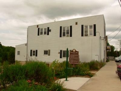
More about this marker. The marker originally was placed in the “triangle” formerly situated between three adjoining streets—Water, Adams, Exchange—but was apparently removed during bridge and road construction in the area in 2009. The marker is now located on the north side of Water Street (County Highway B) at the former mill property, currently owned by Dane County Parks. A rededication ceremony was held on August 13, 2011.
Additional commentary.
1. Rockdale Mill historical marker
The Rockdale Mill historical marker originally was placed in the “triangle” formerly situated between three adjoining streets—Water, Adams, Exchange—and now is located on the north side of Water St(County Highway B) at the former mill property, currently owned
by Dane County Parks, at a location directly west of the site identified on your web page as its former (and incorrect) previous location. It is located at the western edge of the county highway right-of-way, about 100 feet south of the nearest adjoining private property. A rededication ceremony is planned for August 13, 2011.
— Submitted August 2, 2011, by Richard Moen of Rockdale, Wisconsin.
Credits. This page was last revised on June 16, 2016. It was originally submitted on September 7, 2010, by William J. Toman of Green Lake, Wisconsin. This page has been viewed 1,255 times since then and 76 times this year. Last updated on September 19, 2011, by Paul Fehrenbach of Germantown, Wisconsin. Photos: 1. submitted on September 19, 2011, by Paul Fehrenbach of Germantown, Wisconsin. 2. submitted on September 7, 2010, by William J. Toman of Green Lake, Wisconsin. 3. submitted on September 19, 2011, by Paul Fehrenbach of Germantown, Wisconsin. 4, 5. submitted on September 7, 2010, by William J. Toman of Green Lake, Wisconsin.
