Alpine in Bergen County, New Jersey — The American Northeast (Mid-Atlantic)
Untangling Folklore from Fact
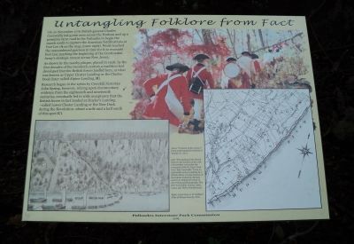
On 20 November 1776 British general Charles Cornwallis led 5,000 men across the Hudson and up a primitive farm road in the Palisades to begin the march south to capture the American fortifications at Fort Lee (A on the map, lower right). Word reached the outnumbered garrison in time for it to evacuate Fort Lee, marking the beginning of the Continental Army’s strategic retreat across New Jersey.
As shown by the nearby plaque, placed in 1928, by the first decades of the twentieth century a tradition had developed that the British forces landed here, at what was known as Upper Closter Landing or the Closter Dock (later called Alpine Landing, B).
Research begun in the 1960s by Cresskill historian John Spring, however, relying upon documentary evidence from the eighteenth and nineteenth centuries, eventually led to wide acceptance that the British forces in fact landed at Huyler’s Landing – called Lower Closter Landing or the New Dock during the Revolution – about a mile and a half south of this spot (C).
Erected 2009 by Palisades Interstate Park Commission.
Topics. This historical marker is listed in this topic list: War, US Revolutionary. A significant historical date for this entry is November 20, 1776.
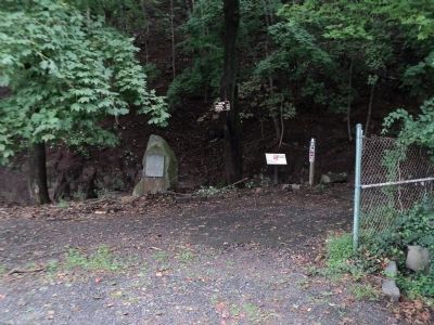
Location. 40° 56.832′ N, 73° 55.128′ W. Marker is in Alpine, New Jersey, in Bergen County. Marker can be reached from Alpine Approach Road. Marker is in the Palisades Interstate Park at the end of the Alpine Approach Road, north of the Alpine Boat Basin. Touch for map. Marker is in this post office area: Alpine NJ 07620, United States of America. Touch for directions.
Other nearby markers. At least 8 other markers are within 2 miles of this marker, measured as the crow flies. Cornwallis Headquarters (a few steps from this marker); The Old Alpine Trail (a few steps from this marker); Along the Palisades Riverfront (about 400 feet away, measured in a direct line); Alpine Community Church (approx. 0.4 miles away); Closter Dock Road (approx. 0.4 miles away); 1776: British Invasion of New Jersey (approx. 1.2 miles away); Rionda’s Tower (approx. 1.2 miles away); Lower Closter or New Dock (approx. 1½ miles away). Touch for a list and map of all markers in Alpine.
More about this marker. The upper right of the marker features a picture of British troops ascending the palisades. It has a caption of “ ‘Invasion of the Jerseys.’ From a photograph by Anthony G. Taranto Jr., 2001.” The bottom left contains a picture with the caption “ ‘The landing of the British forces in the Jerseys on the 20th of November 1776 under the command of the Rt. Honl. Lieut. Genl. Earl Cornwallis.’ From an eighteenth-century painting by a British officer. (Image courtesy of the Emmet Collection, Miriam and Ira D. Wallach Division of Art, Prints and Photographs, The New York Public Library, Astor, Lenox and Tilden Foundations.)” Next to this is a picture showing “Detail from A. H. Walker’s Atlas of Bergen County, 1876.” which shows the location of sites mentioned on the marker.

Photographed By Bill Coughlin, September 24, 2011
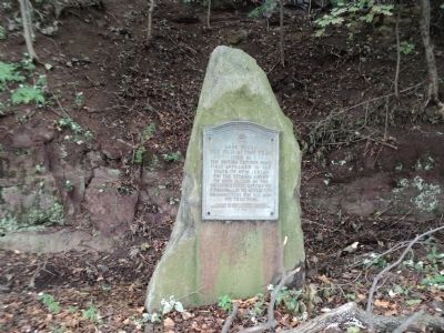
4. Old Alpine Trail Marker
The Old Alpine Trail
used by the British troops who first appeared in the State of New Jersey on the stormy night of Nov. 18, 1776 in the unsuccessful effort of Cornwallis to intercept Washington on his way to Trenton.
Credits. This page was last revised on June 16, 2016. It was originally submitted on September 24, 2011, by Bill Coughlin of Woodland Park, New Jersey. This page has been viewed 996 times since then and 27 times this year. Photos: 1, 2, 3, 4. submitted on September 24, 2011, by Bill Coughlin of Woodland Park, New Jersey.


