Edgefield in Edgefield County, South Carolina — The American South (South Atlantic)
Edgefield
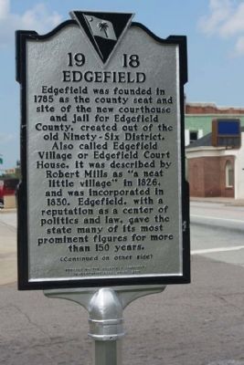
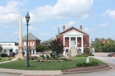
Edgefield was founded in 1785 as the county seat and site of the new courthouse and jail for Edgefield County, created out of the old Ninety-Six District. Also called Edgefield Village or Edgefield Court House, it was described by Robert Mills as “a neat little village’ in 1826, and was incorporated in 1830. Edgefield, with a reputation as a center of politics and law, gave the state many of its most prominent figures for more than 150 years.
(Reverse text)
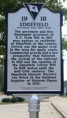
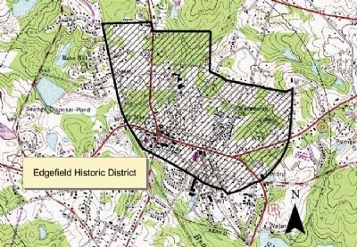
Ten governors and five lieutenant governors of S.C. from 1812 to 1951 were natives or residents of Edgefield or the county. Cotton was the major crop in the area for many years. Commercial growth and a new prosperity that followed the arrival of the railroad in 1888 and the opening of the Edgefield Cotton Mill in 1898 lasted until the mid-20th century. The Edgefield Historic District was listed in the National Register of Historic Places in 1972.
Erected 2011 by The Edgefield Community Development Association. (Marker Number 19-18.)
Topics. This historical marker is listed in this topic list: Notable Places. A significant historical year for this entry is 1785.
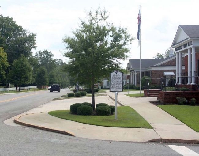
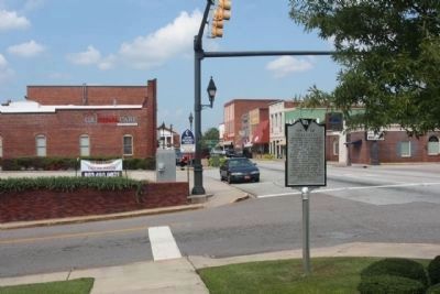
Location. 33° 47.338′ N, 81° 55.652′ W. Marker is in Edgefield, South Carolina, in Edgefield County. Marker is at the intersection of Main Street (U.S. 25) and Bacon Street, on the right when traveling east on Main Street. Located at the Town Hall. Touch for map. Marker is in this post office area: Edgefield SC 29824, United States of America. Touch for directions.
Other nearby markers. At least 8 other markers are within walking distance of this marker. Edgefield United Methodist Church / The Reverend Joseph Moore (about 300 feet away, measured in a direct line); The Jewish Merchants of Edgefield (about 400 feet away); Welcome to Historic Edgefield (about 500 feet away); J. Strom Thurmond (about 500 feet away); Lynch Building (about 500 feet away); Mercantile Building (about 500 feet away); The Booth-Toney Shootout of 1878 (about 600 feet away); Israel Mukashy Building (about 600 feet away). Touch for a list and map of all markers in Edgefield.
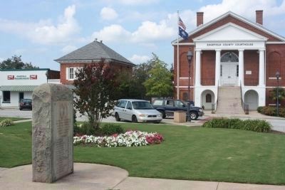
Regarding Edgefield. As early as 1787, the village green near Court House Square was deeded to the town of Edgefield. Several significant buildings surrounding the landscaped square remain unaltered, and the initial layout of the town has not changed. More than forty nineteenth-century buildings are within the historic area, three of which are house museums. There are a number of nineteenth- century Greek Revival homes with large central halls and the basic four-rooms-over-four floor plan. Many of Edgefield’s houses are noted for beautiful Federal style fanlights and unusual doorways, and many have heart pine floors, board or plaster walls, central medallions, window boxing, wainscoting and six-panel doors. A few retain original trompe l’oeil to simulate woodgrains finer than that available in the area. Other district properties include Victorian influenced homes and downtown commercial buildings. Five churches represent the Georgian, Victorian Gothic, and modified Gothic architectural styles. Much of Edgefield’s significance results from its large number of important government figures: ten former South Carolina governors; five lieutenant governors; and several U.S. Congressmen and Senators. Edgefield is also known for its military history. During the American Revolution the town was vital due to its location on the route between British strongholds Augusta and Ninety-Six. Local figures also participated in the Mexican War, Civil War and Spanish American War, and during Reconstruction local leaders staged organizational meetings here. Listed in the National Register March 23, 1972. (South Carolina Department of Archives and History.)
South Carolina Department of Archives and History, `
3. Edgefield Historic District
National Register of Historic Places:
Edgefield Historic District ** (added 1972 - - #72001207)
Both sides of U.S. 25 through town of Edgefield
Period of Significance: 1900-1924, 1875-1899, 1850-1874, 1825-1849, 1800-1824, 1750-1799
Click for more information.
Period of Significance: 1900-1924, 1875-1899, 1850-1874, 1825-1849, 1800-1824, 1750-1799
Click for more information.
Photographed By Mike Stroud
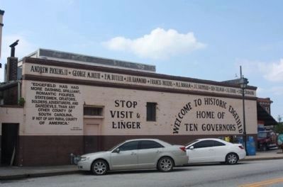
6. Welcome to Historic Edgefield
Andrew Pickens, II * George McDuffie
* P.M. Butler * J.H. Hammond
* Francis Pickins * M.L. Bonham
* J.C. Sheppard * Ben Tillman
* J.G. Evans * Strom Thurmond
" Edgefield has had
more dashing, brilliant,
romantic figures,
statesmen, orators,
soldiers, adventurers, and
daredevils, than any
other county of
South Carolina,
if not any rural county
of America."
W.W. Ball
The State That Forgot
Stop
Visit &
Linger
Photographed By Mike Stroud, 2011
8. Edgefield County Courthouse and Governors Memorial, at Courthouse Square
* See related marker
Click for more information.
Click for more information.
Credits. This page was last revised on June 16, 2016. It was originally submitted on September 24, 2011, by Mike Stroud of Bluffton, South Carolina. This page has been viewed 667 times since then and 27 times this year. Photos: 1, 2, 3, 4, 5, 6, 7. submitted on September 26, 2011, by Mike Stroud of Bluffton, South Carolina. 8. submitted on September 27, 2011, by Mike Stroud of Bluffton, South Carolina.
