Frontenac in Goodhue County, Minnesota — The American Midwest (Upper Plains)
Wakondiota Park
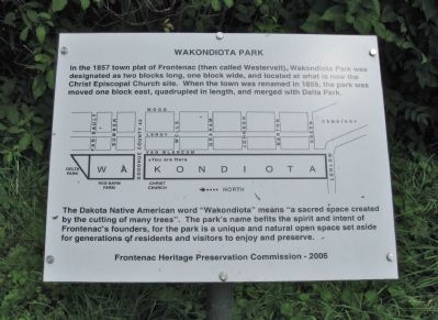
[Frontenac street map]
The Dakota Native American word "Wakondiota" means "a sacred space created by the cutting of many trees". The park's name befits the spirit and intent of Frontenac's founders, for the park is a unique and natural open space set aside for generations of residents and visitors to enjoy and preserve.
Erected 2006 by the Frontenac Heritage Preservation Commission.
Topics. This historical marker is listed in this topic list: Settlements & Settlers. A significant historical year for this entry is 1857.
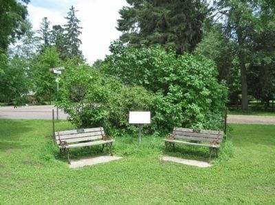
Location. 44° 31.55′ N, 92° 20.066′ W. Marker is in Frontenac, Minnesota, in Goodhue County. Marker is at the intersection of County 2 Boulevard and Van Blarcum Avenue, on the right when traveling east on County 2 Boulevard. Marker is in Wakondiota Park. Touch for map. Marker is in this post office area: Frontenac MN 55026, United States of America. Touch for directions.
Other nearby markers. At least 8 other markers are within 6 miles of this marker, measured as the crow flies. Christ Episcopal Church (about 500 feet away, measured in a direct line); Frontenac (approx. ¼ mile away); Fort Beauharnois (approx. 1.4 miles away); Lake Pepin's Shell Game / In Search of Summer (approx. 2½ miles away); Maiden Rock (approx. 2½ miles away); a different marker also named Maiden Rock (approx. 2.8 miles away in Wisconsin); Lake Pepin (approx. 3.8 miles away in Wisconsin); The Sea Wing Disaster (approx. 5½ miles away). Touch for a list and map of all markers in Frontenac.
Also see . . . Frontenac, Minnesota. (Submitted on October 5, 2011.)
Credits. This page was last revised on June 16, 2016. It was originally submitted on October 5, 2011, by Keith L of Wisconsin Rapids, Wisconsin. This page has been viewed 669 times since then and 23 times this year. Photos: 1, 2. submitted on October 5, 2011, by Keith L of Wisconsin Rapids, Wisconsin.

