Fort Trumbull in New London in New London County, Connecticut — The American Northeast (New England)
War of 1812
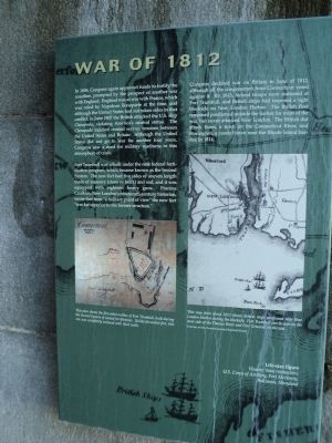
In 1808, Congress again approved funds to fortify the coastline, prompted by the prospect of another war with England. England was at war with France, which was ruled by Napoleon Bonaparte at the time, and although the United States had not taken sides in that conflict, in June 1807 the British attacked the U.S. ship Chesapeake, violating America’s neutral status. The Chesapeake incident created serious tensions between the United States and Britain. Although the United States did not go to war for another four years, Congress saw a need for military readiness in this atmosphere of crisis.
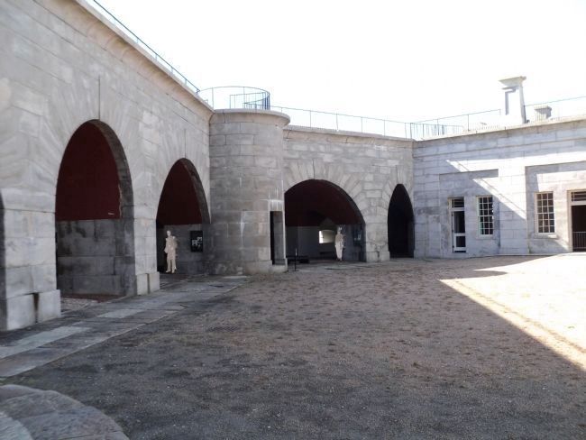
Fort Trumbull was rebuilt under the new federal fortification program, which became known as the Second System. The new fort had five sides of uneven length made of masonry (stone or brick) and sod, and it was equipped with eighteen heavy guns. Frances Caulkins, New London’s nineteenth-century historian, wrote that from “a military point of view” the new fort “was far superior to the former structure.”
Congress declared war on Britain in June of 1812, although all the congressmen from Connecticut voted against it. By 1813, federal troops were stationed at Fort Trumbull, and British ships had imposed a tight blockade on New London Harbor. The British fleet remained positioned outside the harbor for most of the war, but never attacked New London. The British did attack Essex, a town on the Connecticut River, and Stonington, a coastal town near the Rhode Island border, in 1814.
Erected by Fort Trumbull State Park.
Topics. This historical marker is listed in these topic lists: Forts and Castles • War of 1812. A significant historical month for this entry is June 1807.
Location. 41° 20.61′ N, 72° 5.604′ W. Marker is in New London, Connecticut, in New London County. It is in Fort Trumbull. Marker can be reached from East Street, on the left when traveling south. Marker is located inside the fort at Fort Trumbull State Park. Touch for map. Marker is in this post office area: New London CT 06320, United States of America. Touch for directions.
Other nearby markers. At least 8 other markers are within walking distance of this marker. American Revolution (here, next to this marker); The Third System (here, next to this marker); Fort Interiors (here, next to this marker); Civil War (a few steps from this marker); Coast Guard (a few steps from this marker); Post Civil War to 1910 (a few steps from this marker); “Aim, Load, Fire” (a few steps from this marker); Scientific Research (within shouting distance of this marker). Touch for a list and map of all markers in New London.
More about this marker. A map of Fort Trumbull at the lower left of the marker has a caption of “This plan shows the five-sided outline of Fort Trumbull, built during the Second System of coastal fortification. Unlike the earlier fort, this one was completely enclosed with thick walls.”
A second map at the lower right includes the caption “This map from about 1813 shows British ships positioned near new London Harbor during the blockade. Fort Trumbull can be seen on the west side of the Thames River and Fort Griswold on the east.
Courtesy of New London County Historical Society.”
Also see . . . History of Fort Trumbull. Friends of Fort Trumbull website. (Submitted on October 13, 2011, by Bill Coughlin of Woodland Park, New Jersey.)
Credits. This page was last revised on May 6, 2023. It was originally submitted on October 13, 2011, by Bill Coughlin of Woodland Park, New Jersey. This page has been viewed 673 times since then and 7 times this year. Photos: 1, 2, 3. submitted on October 13, 2011, by Bill Coughlin of Woodland Park, New Jersey. 4. submitted on October 14, 2011, by Bill Coughlin of Woodland Park, New Jersey.


