Near Oak Harbor in Ottawa County, Ohio — The American Midwest (Great Lakes)
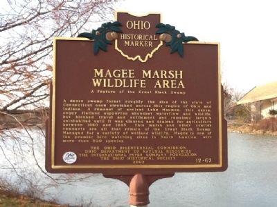
Magee Marsh Wildlife Area
A Feature of the Great Black Swamp
Erected 2003 by The Ohio Bicentennial Commission, Ohio Department of Natural Resources, The International Paper Company Foundation, The Ohio Historical Society. (Marker Number 12-62.)
Topics and series. This historical marker is listed in these topic lists: Horticulture & Forestry • Notable Places. In addition, it is included in the Ohio Historical Society / The Ohio History Connection series list. A significant historical year for this entry is 1860.
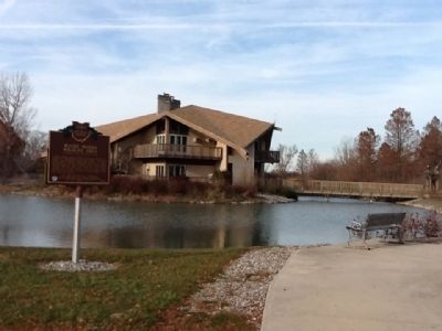
Location. 41° 36.694′ N, 83° 11.308′ W. Marker is near Oak Harbor, Ohio, in Ottawa County. Marker can be reached from 13229 West State Route 2, 2˝ miles east of North Stange Road. Entrance road leaves the north side of West State Route 2 past Black Swamp Bird Observatory Nature Center .5 mile left into Sportman's Migratory Bird Center parking lot. Touch for map. Marker is in this post office area: Oak Harbor OH 43449, United States of America. Touch for directions.
Other nearby markers. At least 8 other markers are within 5 miles of this marker, measured as the crow flies. History Of Magee Marsh (here, next to this marker); Sport Fish & Wildlife Restoration (a few steps from this marker); Purple Martins (about 300 feet away, measured in a direct line); Ward's Canal (approx. 4.1 miles away); Veterans Memorial (approx. 4.4 miles away); Carroll Township Hall (approx. 4˝ miles away); Howard Marsh (approx. 4˝ miles away); The Changing Faces of Howard Marsh (approx. 4˝ miles away). Touch for a list and map of all markers in Oak Harbor.
Credits. This page was last revised on August 30, 2023. It was originally submitted on November 19, 2011, by Thomas Cluckey II of Oregon, Ohio. This page has been viewed 517 times since then and 21 times this year. Last updated on August 28, 2023, by Grant & Mary Ann Fish of Galloway, Ohio. Photos: 1, 2, 3. submitted on November 19, 2011, by Thomas Cluckey II of Oregon, Ohio. • Bill Pfingsten was the editor who published this page.


