Harmans near Hanover in Anne Arundel County, Maryland — The American Northeast (Mid-Atlantic)
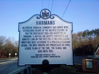
Harmans
Erected by Maryland Historical Trust, Maryland State Highway Administration.
Topics and series. This historical marker is listed in these topic lists: African Americans • Education • Settlements & Settlers. In addition, it is included in the Maryland Historical Trust, and the Rosenwald Schools series lists. A significant historical year for this entry is 1918.
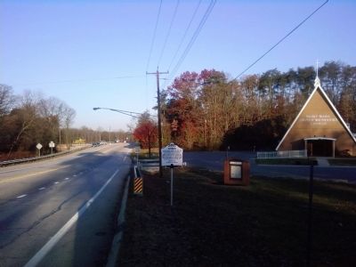
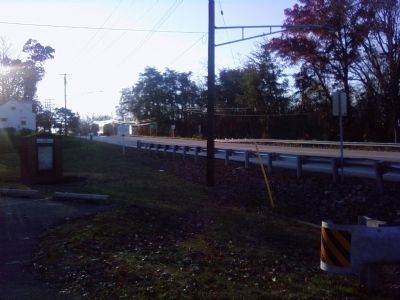
Location. 39° 9.702′ N, 76° 43.017′ W. Marker is near Hanover, Maryland, in Anne Arundel County. It is in Harmans. Marker is on Dorsey Road (State Road 176) 0.1 miles west of Arundel Mills Blvd / New Ridge Road (State Road 713), on the right when traveling west. Marker is located in front of the Saint Mark United Methodist Church. Touch for map. Marker is at or near this postal address: 1430 Dorsey Rd, Hanover MD 21076, United States of America. Touch for directions.
Other nearby markers. At least 8 other markers are within 3 miles of this marker, measured as the crow flies. Wesley Grove United Methodist Church (approx. half a mile away); Stoney Run Train Station (approx. 2.2 miles away); XAF Radar Antenna (approx. 2.9 miles away); FuG 65 Wurzburg Riese (Giant) Radar Antenna (approx. 2.9 miles away); SCR-270 Radar Antenna (approx. 2.9 miles away); AN/SPG-55B Radar (approx. 2.9 miles away); Nike Ajax (approx. 3 miles away); TPS-43 (approx. 3 miles away). Touch for a list and map of all markers in Hanover.
Credits. This page was last revised on April 3, 2023. It was originally submitted on November 21, 2011, by Lee Hattabaugh of Capshaw, Alabama. This page has been viewed 1,105 times since then and 47 times this year. Photos: 1, 2, 3. submitted on November 21, 2011, by Lee Hattabaugh of Capshaw, Alabama. • Bill Pfingsten was the editor who published this page.


