Near Bridgeport in Mono County, California — The American West (Pacific Coastal)
Fremont’s Trail 1844
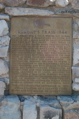
On January 27th, a cold winter day in 1844, Captain John C. Fremont and his guide Kit Carson led a small band of half-starved men west past this point. They were in search of the fabled Buena Ventura River, which they believed would give them easy passage through the high range to the west and on to the fort of John Sutter. A short way northwest of here, they were forced to abandon their howitzer because of the deep snow, as their tired men could no longer pull the 1500 pound gun and caisson. In desperation, Fremont decided to force a winter crossing of the great Sierra Nevada. They succeeded, and with his band of courageous men reprovisioned themselves at Sutter’s Fort and then recrossed the Great Basin arriving in St. Louis, Missouri on August 6, 1844. A year later, Fremont was back in California and was the United States officer who, on January 15, 1847, received the surrender of the California forces under General Andres Pico at Cahuenga Pass.
Erected 1977 by E Clampus Vitus Bodie Chapter No. 64; and Mono County Board of Supervisors. (Marker Number 995.)
Topics and series. This historical marker is listed in this topic list: Exploration. In addition, it is included in the California Historical Landmarks, and the E Clampus Vitus series lists. A significant historical year for this entry is 1844.
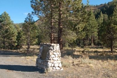
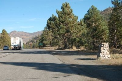
Location. 38° 20.91′ N, 119° 21.863′ W. Marker is near Bridgeport, California, in Mono County. Marker is on Three Flags Highway (U.S. 395), on the right when traveling south. The marker is located at Devil's Gate Summit on Highway 395 between Sonora Junction and Bridgeport. Touch for map. Marker is in this post office area: Bridgeport CA 93517, United States of America. Touch for directions.
Other nearby markers. At least 8 other markers are within 10 miles of this marker, measured as the crow flies. Hunewill Upper Sawmill (approx. 7.8 miles away); Mountain Warfare Training Center (approx. 8.1 miles away); East Walker Toll House (approx. 8½ miles away); Bridgeport Elementary School (approx. 9.6 miles away); Mono County Memorial Hall (approx. 9.7 miles away); Old County Jail (approx. 9.7 miles away); Bridgeport Chronicle-Union (approx. 9.7 miles away); Mono County Court House (approx. 9.8 miles away). Touch for a list and map of all markers in Bridgeport.
Regarding Fremont’s Trail 1844. In 1991 this site was designated California Historical Landmark No. 995-1 Trail of the John C. Fremont 1884 Expedition. “In 1844, while exploring and mapping the area of what is presently the western United States, Lt. John C. Frémont's party passed through northern Mono County during the last week of January. After passing through Mono County, Frémont passed over the Sierra and travelled to Sutter's Fort in the Sacramento Valley, where the party rested. To leave California the expedition headed south through the San Joaquin Valley, and then headed easterly to leave California by the Old Spanish Trail to Utah.”
Related marker. Click here for another marker that is related to this marker. - “Frémont 1844 Expedition” is also California Historical Landmark No. 995.
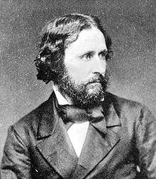
Also see . . . John C. Frémont. Wikipedia entry (Submitted on September 18, 2021, by Larry Gertner of New York, New York.)
Credits. This page was last revised on February 21, 2024. It was originally submitted on November 27, 2011, by Barry Swackhamer of Brentwood, California. This page has been viewed 1,340 times since then and 68 times this year. Photos: 1, 2, 3. submitted on November 27, 2011, by Barry Swackhamer of Brentwood, California. 4. submitted on November 29, 2011. • Syd Whittle was the editor who published this page.


