Los Alamitos in Orange County, California — The American West (Pacific Coastal)
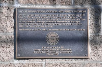
Los Alamitos Sugar Company and Town's Founding
Inscription.
The first sugar beet processing plant in Orange County was built here in 1897 on land donated by the Bixby Land Company. The industry brought jobs and development that created the new town of Los Alamitos. Although nematode infestation of the sugar beets and changes in the economy forced the plant to close in 1926, the town continued to grow.
Erected 1997 by Orange County Board of Supervisors and Orange County Historical Commission. (Marker Number 46.)
Topics. This historical marker is listed in these topic lists: Industry & Commerce • Notable Places • Settlements & Settlers. A significant historical year for this entry is 1897.
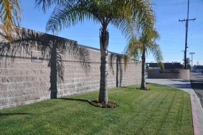
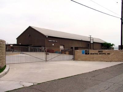
Location. 33° 48.521′ N, 118° 4.139′ W. Marker is in Los Alamitos, California, in Orange County. Marker is on Sausalito Street, on the right when traveling west. Touch for map. Marker is at or near this postal address: 3651 Sausalito Street, Los Alamitos CA 90720, United States of America. Touch for directions.
Other nearby markers. At least 8 other markers are within 3 miles of this marker, measured as the crow flies. This Big Saw (approx. ¼ mile away); St. Isidore Historical Plaza (approx. 0.4 miles away); The Freedom Tree (approx. 2 miles away); Challenger Crew (approx. 2 miles away); Cypress Police Memorial (approx. 2 miles away); Ranchos Los Alamitos - Los Cerritos - Los Coyotes (approx. 2.3 miles away); “Big Red Cars” (approx. 2.4 miles away); a different marker also named “Big Red Cars” (approx. 2½ miles away). Touch for a list and map of all markers in Los Alamitos.
Credits. This page was last revised on June 16, 2016. It was originally submitted on November 30, 2011, by Michael Kindig of Elk Grove, California. This page has been viewed 899 times since then and 47 times this year. Photos: 1, 2. submitted on January 25, 2012, by Michael Kindig of Elk Grove, California. 3, 4. submitted on November 30, 2011, by Michael Kindig of Elk Grove, California. • Syd Whittle was the editor who published this page.


