Coatesville in Chester County, Pennsylvania — The American Northeast (Mid-Atlantic)
The Lukens Mill - Late 1800s
The Lukens National Historic District
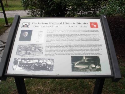
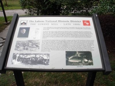
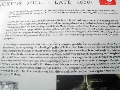
In 1890, the firm added another mill, this one with three rolls 34" in diameter and 120" in length between mill stands. The 3-high configuration permitted the passing of material in both directions through the mill. This is believed to have been the largest mill in the United States at that time. Driven by a large Corliss steam engine, the mill was equipped with cooling tables, hydraulic lifting equipment, and transfer apparatus to move the plates easily to shearing areas. When operated as a finishing mill, it facilitated the rolling of steel, which Lukens had begun to roll about 1881, and which was rapidly supplanting iron for most industrial purposes.
A technological development that was to become a company speciality was the manufacture of heads, or bowllike shapes, by hot spinning. As a leading supplier of boiler plate, Lukens saw new market potential in being able to supply the builders of steam boilers, tanks, and pressure vessels with formed heads for end closures as well. Prior to the invention of spinning machines, heads were formed by hammering, or "bumping" hot plates with heavy mauls, done either over a stationary form, or using a forming pit dug into the ground. It was a long and laborious prices, often requiring several reheatings of the plate to complete the job. During a visit to St. Louis in 1883, Dr. Huston and his son saw an early spinning machine in operation and were sufficiently impressed to order one for Lukens. The company's first spinning machine was put into operation in 1885. The first machine was belt driven and could produce heads up to 7' outside diameter and up to 1" thick.
Topics. This historical marker is listed in this topic list: Industry & Commerce. A significant historical year for this entry is 1870.
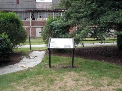
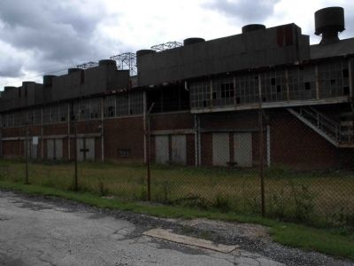
Location. 39° 58.847′ N, 75° 49.373′ W. Marker is in Coatesville, Pennsylvania, in Chester County. Marker is on S. 1st Street, 0.1 miles Harmony Street. The The Lukens 112/120 Mill Complex alluded to in the interpretive is 350 feet from South 1st Street. The interpretive is 260 feet from South 1st Street and exactly 75 feet from this facilities building/plant (82 feet from the most northern part or front right corner of the building). This is the first building to the immediate left of the executive offices. The mill plant is rather long, about 424 feet long. The marker faces the mill building. The markers are the standard interpretives, held horizontally, thick black, frame, tilted for good viewing and
maybe 3 or 4 feet off the ground. Touch for map. Marker is in this post office area: Coatesville PA 19320, United States of America. Touch for directions.
Other nearby markers. At least 8 other markers are within walking distance of this marker. The Lukens Mill - Early 1900s (within shouting distance of this marker); The Future of the Trees (within shouting distance of this marker); The Return of the Trees (within shouting distance of this marker); Arcelormittal Plate LLC World Trade Center (within shouting distance of this marker); a different marker also named The Return of the Trees (within shouting distance of this marker); 9/11 Tragedy (within shouting distance of this marker); Terracina (within shouting distance of this marker); The Making of the Trees (within shouting distance of this marker). Touch for a list and map of all markers in Coatesville.
More about this marker. The top left of the marker features a color photo of Dr. Charles Hudson, one of the founders of Lukens Steel Company. Next to that is a simple map of the mill site circa 1870. Beneath this is a 'landscape' picture of the milling area called Valley Panorama from circa 1870. At the bottom left of the marker is an even longer 'landscape' shot of the 84" Rolling Mill. The opposite corner is a picture of an end product discussed in the interpretive, called Spun Heads.
Regarding The Lukens Mill - Late 1800s. This is a very small, esoteric historic district which would normally be only fully understood and appreciated by a very specific cross-section of people. The Walking Tour Project / interpretive program located here successfully incorporates technical information and jargon into an accessible history lesson for Lukens' visitors. The interpretives are very organized and planted right in front of the contributing structure to which they refer. This interpretive focuses on a very specific point of time in which the Lukens Mill was modernizing, becoming technically savvy and embracing the industrial revolution with the addition of new machines designed to increase production, cut labor and ultimately produce a much better product.
Also see . . .
1. The Lukens Historic District and National Iron & Steel Heritage Museum Interpretive Plan. This link is all about the interpretive plan and walking tour which supports and educates visitors about the Lukens Historic District. (Submitted on December 28, 2011, by Eric Milask of Cherry Hill, New Jersey.)
2. Historic District Walking Tour Signage Project. This link offers pictures of all the interpretive within the historic district. (Submitted on December 28, 2011, by Eric Milask of Cherry Hill, New Jersey.)
3. Lukens National Historic District. Self-promoting website to engage and educate
visitors and promote tourism. (Submitted on December 28, 2011, by Eric Milask of Cherry Hill, New Jersey.)
Credits. This page was last revised on December 27, 2023. It was originally submitted on December 28, 2011, by Eric Milask of Cherry Hill, New Jersey. This page has been viewed 588 times since then and 26 times this year. Last updated on November 22, 2023, by Carl Gordon Moore Jr. of North East, Maryland. Photos: 1, 2, 3, 4, 5. submitted on December 28, 2011, by Eric Milask of Cherry Hill, New Jersey. • Bill Pfingsten was the editor who published this page.
