Wall Township in Monmouth County, New Jersey — The American Northeast (Mid-Atlantic)
Church
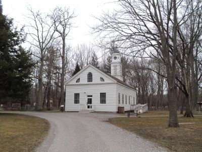
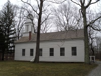
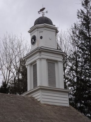
This building was constructed in two parts with the front portion being erected about 1832 from timbers taken from the earlier Monmouth Furnace buildings. The rear section containing the altar, steeple, and bell tower, was added in 1836.
A most unusual feature of the Church is the location of the bell tower at the rear. The front section could not support the weight, thus, necessity forced the placement.
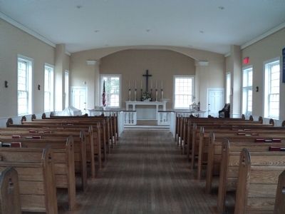
Church met on Sundays, but during the week the pulpit was closed off by sliding doors and the Village School was in session. Usually the minister also served as the School Master at an annual salary of $500.00 for the double job.
Topics. This historical marker is listed in this topic list: Churches & Religion. A significant historical year for this entry is 1832.
Location. 40° 9.468′ N, 74° 7.732′ W. Marker is in Wall Township, New Jersey, in Monmouth County. Marker can be reached from County Route 524, on the left when traveling west. Marker is located in Allaire Village in Allaire State Park. Touch for map. Marker is in this post office area: Farmingdale NJ 07727, United States of America. Touch for directions.
Other nearby markers. At least 8 other markers are within walking distance of this marker. Allaire Village (within shouting distance of this marker); Allentown Station (about 400 feet away, measured in a direct line); PRR Watchman’s Shanty (about 400 feet away); Union Newsstand (about 500 feet away); Freneau Station (about 500 feet away); Millpond (about 600 feet away); 3-Sided Watchman’s Shanty (about 600 feet away); Stone Blocks from the Camden and Amboy Railroad (about 700 feet away). Touch for a list and map of all markers in Wall Township.
Also see . . . The Historic Village at Allaire. Living Museum Website (Submitted on March 3, 2012, by Bill Coughlin of Woodland Park, New Jersey.)
Credits. This page was last revised on February 7, 2023. It was originally submitted on March 3, 2012, by Bill Coughlin of Woodland Park, New Jersey. This page has been viewed 432 times since then and 8 times this year. Photos: 1, 2, 3, 4, 5, 6. submitted on March 3, 2012, by Bill Coughlin of Woodland Park, New Jersey.


