Wall Township in Monmouth County, New Jersey — The American Northeast (Mid-Atlantic)
The Garden State
Eastern Deciduous Forest
— Coastal Habitats —
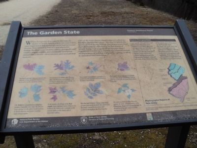
When Europeans first came to the eastern shores of North America they encountered a vast, virgin forest that seemingly stretched westward forever. First viewed as barriers and places for hiding, the trees soon became cabins, gunstocks and cradles, wagon wheels, and eventually newsprint and prefabrications – and economic and recreational treasure.
One of the major forest classifications is called the Eastern Deciduous forest – the type to which the forests of New Jersey belong. Deciduous trees shed their leaves every year during the harshness of winter. Forty-two percent of the Garden State’s vegetation is forest trees. New Jersey’s forests sustain an abundance of wildlife and plants – giving credit to its well deserved nickname.
< Sidebar : >
Forest Composition
Ever wonder why some trees will grow in one place but not in another? Look below the forest canopy to discover one reason. New Jersey, for example, is divided into five physiographic regions, each with its own unique topography and soils. Topography, moisture, and soil are some of the factors that help determine the types of trees that grow in each region. The sandy soils of the inner and outer coastal plains provide nutrients for vegetation different from those found in the higher, rocky soils of the piedmont and highlands. What other factors and conditions might determine the types of trees growing here?
Erected by State of New Jersey, Division of Parks & Forestry, National Park Service.
Topics. This historical marker is listed in this topic list: Horticulture & Forestry.
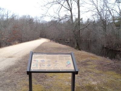
Location. 40° 9.528′ N, 74° 8.023′ W. Marker is in Wall Township, New Jersey, in Monmouth County. Marker can be reached from County Route 524, on the left when traveling west. Marker is located in Allaire State Park near the Nature Center. Touch for map. Marker is in this post office area: Farmingdale NJ 07727, United States of America. Touch for directions.
Other nearby markers. At least 8 other markers are within walking distance of this marker. Watersheds (within shouting distance of this marker); Songs Of The Season (about 400 feet away, measured in a direct line); Wandering Warblers (about 400 feet away); Stone Blocks from the Camden and Amboy Railroad (approx. 0.2 miles away); 3-Sided Watchman’s Shanty (approx. 0.2 miles away); Freneau Station (approx. 0.2 miles away); Union Newsstand (approx. 0.2 miles away); Allentown Station (approx. ¼ mile away). Touch for a list and map of all markers in Wall Township.
More about this marker. A number of tree illustrations with descriptions, courtesy of A Field Guide of the Pine Barrens of New Jersey
and Trees of New Jersey & the Mid-Atlantic States by NJDPF appear at the bottom of the marker. These include:
Northern red oak (Quercus rubra) is the state tree of New Jersey. It is popular for use in urban parks and along streets.
The acorns of the White oak (Quercus alba) are one of the most popular food sources for many birds and animals. It is found throughout New Jersey.
Sweet gum (Liquidambar styraciflua) is common in the swamps and lowlands of the inner coastal plain.
Black gum (Nyssa sylvatica) is typically found in New Jersey’s freshwater swamps and bogs. In the fall, the leaves turn a deep burgundy.
The Tuliptree (Liriodendron tulipifera) produces beautiful, erect tulip-like flowers every spring. It is the tallest hardwood tree in North America and prefers wooded slopes along streams.
In the autum, the foliage of the Red maple (Acer rubrum) turns crimson red. It favors the fresh water wetlands of the coastal plains or the shady side of mountain valleys.
Mockernut hickory (Carya tomentosa) is more commonly found in the uplands of the inner coastal plains, but is also scattered throughout the Pine Barrens.
The stark contrast of white blossoms against the dark, naked branches of the Flowering dogwood (Cornus florida) in the early spring, give way to scarlet berries in the fall.
The sidebar contains a map of New Jersey shows the Physiographic Regions of New Jersey, including Ridge and Valley, Highlands, Piedmont, Inner Coastal Plain and Outer Coastal Plain.
Also see . . . New Jersey Coastal Heritage Trail Route. National Park Service website. (Submitted on March 3, 2012, by Bill Coughlin of Woodland Park, New Jersey.)
Credits. This page was last revised on February 7, 2023. It was originally submitted on March 3, 2012, by Bill Coughlin of Woodland Park, New Jersey. This page has been viewed 448 times since then and 14 times this year. Photos: 1, 2, 3. submitted on March 3, 2012, by Bill Coughlin of Woodland Park, New Jersey.


