Britton's Neck in Marion County, South Carolina — The American South (South Atlantic)
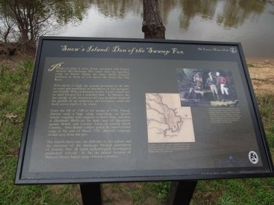
Snow’s Island: Den of the Swamp Fox
With plenty of high, dry ground protected on all sides by water and marshland, an abundance of fish and game, and friendly Whig settlements nearby, Snow’s Island was an ideal location for a secluded base. In Marion’s day, the canopy of the enormous old trees probably hindered the growth of an understory, and horsemen could ride freely across much of the island.
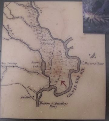
From the fall of 1780 to the spring of 1781, Francis Marion used a large camp somewhere on Snow’s Island ~ together with outposts at Port’s Ferry and here at Dunham’s Bluff ~ as his main base of operations against British and Loyalist forces in eastern South Carolina. After British soldiers raided the Snow’s Island camp at the end of March 1781, Marion’s campaign shifted away from this area.
The island’s sheer size, the difficulty of the terrain, and the alteration of the landscape through generations of forestry have all made archaeological investigation particularly difficult. So far, the precise location of Marion’s Snow’s Island camp remains a mystery.
Erected 2012 by Francis Marion Trail Commission of Francis Marion University.
Topics and series. This historical marker is listed in this topic list: War, US Revolutionary. In addition, it is included in the Francis Marion Trail series list. A significant historical month for this entry is March 1781.
Location. 33° 50.543′ N, 79° 20.443′ W. Marker is in Britton's Neck, South Carolina, in Marion County. Marker is on Bluff Road, on the right when traveling south. the marker is at the end of Bluff Road at the river. Touch for map. Marker is in this post office area: Gresham SC 29546, United States of America. Touch for directions.
Other nearby markers. At least 8 other markers are within 7 miles of this marker, measured as the crow flies. Marion's Camp at Snow's Island (approx. 1.7 miles away); Britton's Neck / Britton's Ferry (approx. 1.7 miles away); Ebenezer United Methodist Church (approx. 6 miles away); General Francis Marion (approx. 6.2 miles away); Witherspoon’s Ferry: Francis Marion Takes Command (approx. 6.2 miles away); Francis Marion at Witherspoon's Ferry (approx. 6.2 miles away); Witherspoon’s Ferry / Johnsonville (approx. 6.2 miles away); Marion at Port’s Ferry / Asbury at Port’s Ferry (approx. 6.2 miles away). Touch for a list and map of all markers in Britton's Neck.

Photographed By Anna Inbody, March 18, 2012
4. Picture on the marker
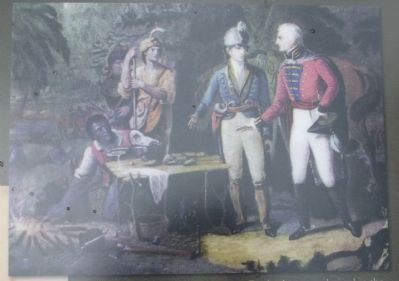
According to Patriot lore popularized in the 19th century, when Francis Marion received a British emissary at his Snow’s Island camp, he offered the visitor a dinner of roasted sweet potatoes and water. When the British officer returned to Charleston, he refused to fight against an enemy that could so successfully live off the land.
Credits. This page was last revised on June 16, 2016. It was originally submitted on March 25, 2012, by Anna Inbody of Columbia, South Carolina. This page has been viewed 3,697 times since then and 195 times this year. Photos: 1, 2, 3, 4, 5. submitted on March 25, 2012, by Anna Inbody of Columbia, South Carolina. • Bill Pfingsten was the editor who published this page.


