Clarkdale in Cobb County, Georgia — The American South (South Atlantic)
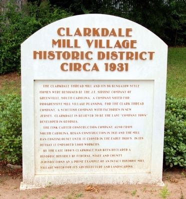
Clarkdale Mill Village Historic District
Circa 1931
The Fisk Carter Construction Company, also of South Carolina, began construction in 1931 and the mill ran continuously until it closed in the early 1980’s. In its heyday it employed 1,000 workers.
By the late 1990’s Clarkdale had been declared a historic district by Federal, State and County jurisdictions as a prime example of an intact historic mill village noted for its architecture and landscaping.
Topics. This historical marker is listed in this topic list: Notable Buildings. A significant historical year for this entry is 1931.
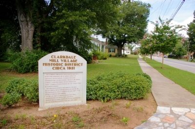
Location. 33° 49.85′ N, 84° 38.983′ W. Marker is in Clarkdale, Georgia, in Cobb County. Marker is at the intersection of Austell Powder Springs Road and Bloomfield Avenue, on the right when traveling south on Austell Powder Springs Road. Touch for map. Marker is in this post office area: Clarkdale GA 30111, United States of America. Touch for directions.
Other nearby markers. At least 8 other markers are within 4 miles of this marker, measured as the crow flies. Clarkdale Historic District (approx. 0.3 miles away); Coats & Clark Thread Mill (approx. 0.3 miles away); Causey - Maxham House (approx. 2.3 miles away); Sweet Water Town Site (approx. 2.6 miles away); Ross' Headquarters (approx. 3.6 miles away); Hardee's Corps at Powder Springs (approx. 3.8 miles away); “The Only Advantage of the Day” (approx. 4 miles away); Site: Wm. Moss House (approx. 4.1 miles away). Touch for a list and map of all markers in Clarkdale.
Credits. This page was last revised on June 16, 2016. It was originally submitted on May 11, 2012, by David Seibert of Sandy Springs, Georgia. This page has been viewed 1,438 times since then and 56 times this year. Photos: 1, 2, 3, 4. submitted on May 11, 2012, by David Seibert of Sandy Springs, Georgia. • Craig Swain was the editor who published this page.


