Near Great Bend in Barton County, Kansas — The American Midwest (Upper Plains)
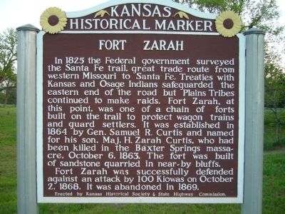
Fort Zarah
Fort Zarah was successfully defended against an attack by 100 Kiowas on October 2, 1868. It was abandoned in 1869.
Erected 2012 by Kansas Historical Society & State Highway Commission. (Marker Number 70.)
Topics and series. This historical marker is listed in this topic list: Forts and Castles. In addition, it is included in the Kansas Historical Society series list. A significant historical date for this entry is October 6, 1772.
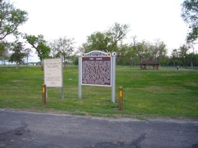
Location. 38° 21.946′ N, 98° 42.8′ W. Marker is near Great Bend, Kansas, in Barton County. Marker is on U.S. 56, on the left when traveling east. In road side Fort Zarah State Park, 1 mile east of town. Touch for map. Marker is in this post office area: Great Bend KS 67530, United States of America. Touch for directions.
Other nearby markers. At least 8 other markers are within 5 miles of this marker, measured as the crow flies. Site of Fort Zarah (within shouting distance of this marker); Veterans of Foreign Wars Memorial (approx. 2.8 miles away); Civil War Memorial (approx. 2.8 miles away); Streetscape (approx. 2.8 miles away); Jack Kilby (approx. 2.8 miles away); ATSF Locomotive No. 3416 (approx. 2.9 miles away); Oscar Micheaux (approx. 4.7 miles away); a different marker also named Civil War Memorial (approx. 4.8 miles away). Touch for a list and map of all markers in Great Bend.
Additional commentary.
1. Previous Inscription
When the marker was replaced in 2012, the text inscription of the marker was changed. The marker previously read,
"To protect commerce on the Santa Fe Trail, the U.S. government established a line of forts from Fort Leavenworth to Fort Dodge. Fort Zarah, built here along Walnut Creek in 1863, was initially made of dugouts and tents. The fort’s two-story octagonal blockhouse was built in 1865 with stone quarried from nearby bluffs. The fort was abandoned in April 1866 then reopened two months later.
Fort Zarah hosted a council with Plains tribes in November 1866 as the U.S. continued to secure lands from the Indians. That year had seen fewer battles, but more conflicts would occur the year after the council.
We made peace on the North Fork of the Platte. We have kept it. Every time we meet the whites in council, they have new men to talk to us. They have new roads to open. We do not like it.—Woqini, or Roman Nose, Cheyenne warrior society, 1866
With trail traffic shifting to rail traffic, the fort was no longer needed and closed in December 1869."
Source: Kansas Historical Society website
— Submitted January 3, 2014, by Duane Hall of Abilene, Texas.
Credits. This page was last revised on November 16, 2020. It was originally submitted on May 13, 2012, by Bill Kirchner of Tucson, Arizona. This page has been viewed 1,212 times since then and 58 times this year. Photos: 1, 2. submitted on May 13, 2012, by Bill Kirchner of Tucson, Arizona. • Bill Pfingsten was the editor who published this page.

