Near Nauvoo in Hancock County, Illinois — The American Midwest (Great Lakes)
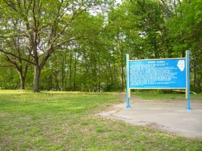
Nauvoo, Illinois
In 1839, the Mormon Prophet Joseph Smith chose the town, then called Commerce, as the home for his followers, who had been driven from Missouri. The Mormons named the community Nauvoo, said to mean “Beautiful Place,” and obtained a special charter from the Illinois Legislature, which gave the city government its own courts, militia, university, and all other governmental powers not prohibited by the Federal and State Constitutions.
Mormon converts from all parts of America and Europe soon swelled the population to about 15,000 making Nauvoo one of the largest cities in Illinois by 1845. But some of the Mormons as well as their Gentile neighbors began to resent the civil and religious authority of the Mormon leaders, and frictions in the area grew severe. When the Nauvoo City Council had an anti-Mormon newspaper destroyed, the Mormon leaders were arrested and jailed at Carthage. There, on June 27, 1844, an armed mob shot and killed Joseph Smith and his brother, Hyrum. Conflict between the Mormons and their neighbors continued until 1846 when the Mormons completed their exodus from the state.
In 1849, Etienne Cabet’s followers, the Icarians, came to Nauvoo to practice their form of religious communism but dissensions soon weakened the colony. Their experiment lasted less than ten years.
Erected 1963 by the Division of Highways and the Illinois State Historical Society.
Topics and series. This historical marker is listed in these topic lists: Churches & Religion • Settlements & Settlers. In addition, it is included in the Illinois State Historical Society, and the Mormon Pioneer Trail series lists. A significant historical month for this entry is June 1932.
Location. 40° 32.362′ N, 91° 23.192′ W. Marker is near Nauvoo, Illinois, in Hancock County. Marker is on Illinois Route 96, 0.1 miles south of Water Street, on the right when traveling south. Marker is just south of town in a road side pull out. Touch for map. Marker is in this post office area: Nauvoo IL 62354, United States of America. Touch for directions.
Other nearby markers. At least 8 other markers are within walking distance of this marker. Historic Nauvoo (here, next to this marker); History Along The Mississippi River Parkway (here, next to this marker); Nauvoo House (approx. ¼ mile away); Bidamon Stable (approx. ¼ mile away); Joseph and Emma Smith's Mansion House (approx. 0.3 miles away); Smith Family Homestead (approx. 0.3 miles away); Nauvoo Survey Stone (approx. 0.3 miles away); The Icarian Community in Nauvoo (approx. 0.3 miles away). Touch for a list and map of all markers in Nauvoo.
Credits. This page was last revised on March 31, 2024. It was originally submitted on May 17, 2012, by Bill Kirchner of Tucson, Arizona. This page has been viewed 611 times since then and 27 times this year. Photos: 1, 2. submitted on May 17, 2012, by Bill Kirchner of Tucson, Arizona. • Bernard Fisher was the editor who published this page.

