Roxbury in Boston in Suffolk County, Massachusetts — The American Northeast (New England)
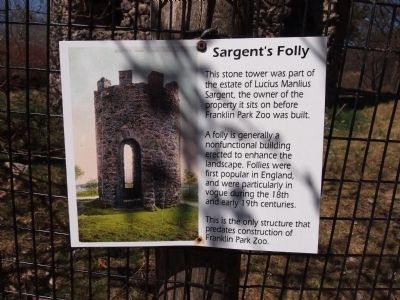
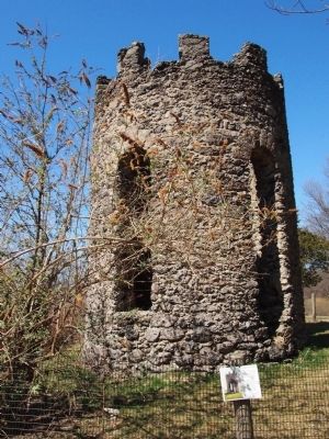
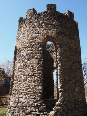
Sargent's Folly
A folly is generally a nonfunctional building erected to enhance the landscape. Follies were first popular in England, and were particularly in vogue during the 18th and early 19th centuries.
This is the only structure that predates construction of Franklin Park Zoo.
Topics. This historical marker is listed in this topic list: Entertainment.
Location. 42° 18.295′ N, 71° 5.255′ W. Marker is in Boston, Massachusetts, in Suffolk County. It is in Roxbury. Marker can be reached from Franklin Park Road. The marker is located in the park near the Lion's den. Touch for map. Marker is at or near this postal address: 1 Franklin Park Rd, Dorchester MA 02121, United States of America. Touch for directions.
Other nearby markers. At least 8 other markers are within 2 miles of this marker, measured as the crow flies. Poitou Donkey (about 500 feet away, measured in a direct line); Tiger (about 500 feet away); Hooded Crane (about 600 feet away); a different marker also named Poitou Donkey (about 700 feet away); Blanding's Turtle (about 700 feet away); Spotted Turtle (about 700 feet away); Reaching New Heights in Boston (approx. ¼ mile away); Dedicated in sorrow to our grandmother (approx. 1.1 miles away). Touch for a list and map of all markers in Boston.
Also see . . . Follys in general from Wikipedia. (Submitted on June 17, 2012, by Bryan Simmons of Attleboro, Massachusetts.)
Credits. This page was last revised on February 6, 2023. It was originally submitted on June 17, 2012, by Bryan Simmons of Attleboro, Massachusetts. This page has been viewed 758 times since then and 47 times this year. Photos: 1, 2, 3. submitted on June 17, 2012, by Bryan Simmons of Attleboro, Massachusetts. • Bill Pfingsten was the editor who published this page.


