Greenwich in Washington County, New York — The American Northeast (Mid-Atlantic)
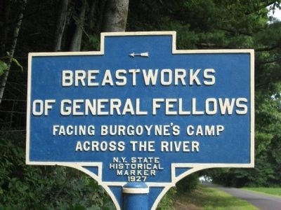
Breastworks of General Fellows
Erected 1927 by New York State.
Topics. This historical marker is listed in this topic list: War, US Revolutionary.
Location. 43° 4.843′ N, 73° 33.838′ W. Marker is in Greenwich, New York, in Washington County. Marker is on General Fellows Road, one mile County Route 113, on the right when traveling west. Touch for map. Marker is in this post office area: Greenwich NY 12834, United States of America. Touch for directions.
Other nearby markers. At least 8 other markers are within 2 miles of this marker, measured as the crow flies. Baum Encampment (approx. 0.9 miles away); General Gates Headquarters (approx. one mile away); Champlain Canal (approx. 1.1 miles away); Fort Vrooman (approx. 1.1 miles away); The Hemlocks (approx. 1.1 miles away); Saratoga Surrender Site (approx. 1.1 miles away); Dutch Reformed Church (approx. 1.2 miles away); The Schuyler House (approx. 1.4 miles away).
More about this marker. The Marker is by the side of the road. The Breastworks are on private property.
Regarding Breastworks of General Fellows. General Fellows had occupied Saratoga (Present day Schuylerville) to block Burgoyne's retreat after the battles of Saratoga near Bemis Heights. When Burgoyne retreated to Schuylerville General Fellows moved to the east side of the river to keep the British from reaching Ft Edwards.
Additional keywords. Burgoyne Campaign, 1777
Credits. This page was last revised on June 16, 2016. It was originally submitted on August 17, 2012, by Tom McGreevy of Averill Park, New York. This page has been viewed 691 times since then and 42 times this year. Photo 1. submitted on August 17, 2012, by Tom McGreevy of Averill Park, New York. • Bill Pfingsten was the editor who published this page.
