Near Markleeville in Alpine County, California — The American West (Pacific Coastal)
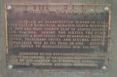
Silver Mountain
Erected 1958 by E Clampus Vitus, Snowshoe Thompson Chapter No. 1827.
Topics and series. This historical marker is listed in this topic list: Notable Places. In addition, it is included in the E Clampus Vitus series list. A significant historical date for this entry is September 13, 1846.
Location. 38° 36.322′ N, 119° 46.161′ W. Marker is near Markleeville, California, in Alpine County. Marker is on Ebbets Pass Scenic Highway (State Highway 4), on the right when traveling east. Touch for map. Marker is in this post office area: Markleeville CA 96120, United States of America. Touch for directions.
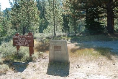
Other nearby markers. At least 8 other markers are within 7 miles of this marker, measured as the crow flies. Historic Silver Mountain City (here, next to this marker); Reynolds Peak (approx. 4.4 miles away); Ebbetts Pass (approx. 4.8 miles away); Webster School (approx. 6.1 miles away); Jacob Markley (approx. 6.1 miles away); Alpine County Courthouse (approx. 6.2 miles away); Markleeville General Store (approx. 6.2 miles away); The Lost Whiskey of Raymond (approx. 6.2 miles away). Touch for a list and map of all markers in Markleeville.
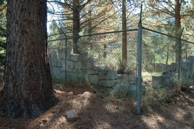
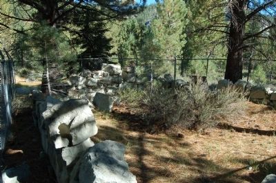
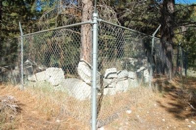
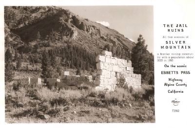
More about this marker. This marker was originally placed on the walls of the old Silver Mountain jail. However, as the walls began to deteriorate and collapse the marker was removed. Only recently has the marker been returned, this time on a new base.
Also see . . .
1. Silver Mountain Jail - Geotourism Map Guide. These roadside remains of a jail are all that is left to offer a glimpse into the historic boom town that was once the infamous Silver Mountain City of Alpine County. (Submitted on August 26, 2012, by Barry Swackhamer of Brentwood, California.)
2. Silver Mountain City - California Ghost Town. Originally called "Kongsberg". Founded in the late 1850's-early 1860's by Scandinavian miners prospecting for silver. By 1863, the name was changed to Silver Mountain City. (Submitted on August 26, 2012, by Barry Swackhamer of Brentwood, California.)
Credits. This page was last revised on July 26, 2018. It was originally submitted on August 26, 2012, by Barry Swackhamer of Brentwood, California. This page has been viewed 758 times since then and 57 times this year. Photos: 1, 2, 3, 4, 5. submitted on August 26, 2012, by Barry Swackhamer of Brentwood, California. 6. submitted on September 15, 2008, by Syd Whittle of Mesa, Arizona. • Syd Whittle was the editor who published this page.
