Santa Clara in Washington County, Utah — The American Mountains (Southwest)
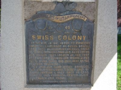
Swiss Colony
The fort and many other buildings, dam and ditches were washed away by floods January 1, 1862. Lack of food, shelter and clothing tested their endurance for years.
Erected 1939 by Santa Clara Swiss Camp, Daughters of Utah Pioneers. (Marker Number 49.)
Topics and series. This historical marker is listed in these topic lists: Churches & Religion • Forts and Castles • Settlements & Settlers. In addition, it is included in the Daughters of Utah Pioneers series list. A significant historical date for this entry is January 1, 1863.
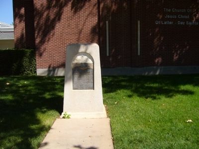
Location. 37° 7.978′ N, 113° 39.239′ W. Marker is in Santa Clara, Utah, in Washington County. Marker is on West Santa Clara Drive, on the right when traveling west. Touch for map. Marker is at or near this postal address: 3040 West Santa Clara Drive, Santa Clara UT 84765, United States of America. Touch for directions.
Other nearby markers. At least 8 other markers are within walking distance of this marker. Santa Clara Relief Society House (within shouting distance of this marker); John George and Susette Bosshard Hafen Home (within shouting distance of this marker); Hug-Gubler Home (within shouting distance of this marker); The Settling of Santa Clara / First Public Buildings / Missionaries and Settlers (within shouting distance of this marker); Preston and Vella Ruth Hafen Home (within shouting distance of this marker); Frederick and Anna Reber Home (within shouting distance of this marker); Santa Clara Merc (about 500 feet away, measured in a direct line); Santa Clara Tithing Granary (about 500 feet away). Touch for a list and map of all markers in Santa Clara.
Credits. This page was last revised on June 16, 2016. It was originally submitted on September 2, 2012, by Bill Kirchner of Tucson, Arizona. This page has been viewed 528 times since then and 23 times this year. Photos: 1, 2, 3. submitted on September 2, 2012, by Bill Kirchner of Tucson, Arizona. • Syd Whittle was the editor who published this page.


