Ottawa in Franklin County, Kansas — The American Midwest (Upper Plains)
Shepherd & McQuesten Building
1870
Inscription.
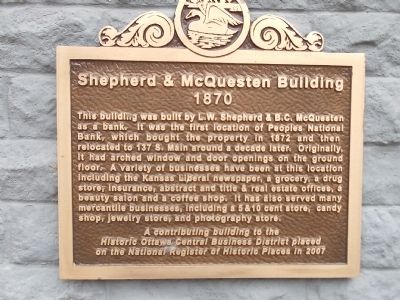
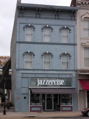
This building was built by L. W. Shepherd & B. C. McQuesten as a bank. It was the first location of Peoples National Bank, which bought the property in 1872 and then relocated to 137 S. Main around a decade later. Originally, it had arched window and door openings on the ground floor. A variety of businesses have been at this location including the Kansas Liberal newspaper, a grocery, a drug store, insurance, abstract and title & real estate offices, a beauty salon, and a coffee shop. It has also served many mercantile businesses, including a 5 & 10 cent store, candy shop, jewelry store, and photography store.
A contributing building to the Historic Ottawa Central Business District placed on the National Register of Historic Places in 2007.
Topics. This historical marker is listed in this topic list: Industry & Commerce. A significant historical year for this entry is 1872.
Location. 38° 36.93′ N, 95° 16.115′ W. Marker is in Ottawa, Kansas, in Franklin County. This marker is on the east side of Main Street on the first building south of the 2nd and Main intersection. Touch for map. Marker is at or near this postal address: 205 South Main Street, Ottawa KS 66067, United States of America. Touch for directions.
Other nearby markers. At least 8 other markers are within walking distance of this marker. Main Street, 200 Block South (a few steps from this marker); Pickrell Building (a few steps from this marker); The Down Town Ottawa Historic District (within shouting distance of this marker); Franklin County Courthouse (about 500 feet away, measured in a direct line); a different marker also named The Franklin County Courthouse (about 700 feet away); Main Street, 400 Block South (approx. 0.2 miles away); Marais de Cygnes River (approx. ¼ mile away); Main Street, 500 Block South and City Park (approx. ¼ mile away). Touch for a list and map of all markers in Ottawa.
More about this marker. This marker probably was placed by the City of Ottawa, but I cannot confirm. The swan at the top is a reference to the Marais Des Cygnes River (Marsh of the Swan) that flows to the north. There is free on street parking at the marker site.
Also see . . .
1. National Register Application. This is the District application form from the Kansas State Historical Society (Submitted on September 3, 2012, by Thomas Onions of Olathe, Kansas.)
2. Franklin County Historical Society. Link to the county historical society located in the Old Train Depot in Ottawa, Ks. (Submitted on September 3, 2012, by Thomas Onions of Olathe, Kansas.)
3. Benjamin Chase McQuesten, of Ottawa, Kan. "Kansas - A Cyclopedia..." (1912) entry (Submitted on December 18, 2020, by Larry Gertner of New York, New York.)
Credits. This page was last revised on December 18, 2020. It was originally submitted on September 3, 2012, by Thomas Onions of Olathe, Kansas. This page has been viewed 390 times since then and 14 times this year. Photos: 1, 2. submitted on September 3, 2012, by Thomas Onions of Olathe, Kansas.

