Cedar City in Iron County, Utah — The American Mountains (Southwest)
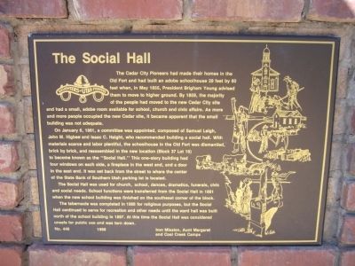
The Social Hall
On January 6, 1861, a committee was appointed, composed of Samuel Leigh, John M. Higbee and Isaac C. Haight, who recommended building a social hall. With materials scarce and labor plentiful, the schoolhouse in the Old Fort was dismantled, brick by brick, and reassembled in the new location (Block 37 Lot 18) to become known as the "Social Hall." This one-story building had four windows on each side, a fireplace in the west end, and a door in the east end. It was set back from the street to where the center of the State Bank of Southern Utah parking lot is located.
The Social Hall was used for church, school, dances, dramatics, funerals, civic and social needs. School functions were transferred from the Social Hall in 1881 when the new school building was finished on the southeast corner of the block.
The tabernacle was completed in 1888 for religious purposes, but the Social Hall continued to serve for recreation and other needs until the ward hall was built north of the school building in 1897. At this time the Social Hall was considered unsafe for public use and was torn down.
Erected 1988 by Iron Mission, Aunt Margaret and Coal Creek Camps – Daughters of Utah Pioneers. (Marker Number 446.)
Topics and series. This historical marker is listed in this topic list: Notable Buildings. In addition, it is included in the Daughters of Utah Pioneers series list. A significant historical month for this entry is January 1851.
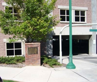
Location. 37° 40.713′ N, 113° 3.604′ W. Marker is in Cedar City, Utah, in Iron County. Marker is on North 100 East, 0.1 miles north of East Center Street, on the left when traveling north. Touch for map. Marker is in this post office area: Cedar City UT 84720, United States of America. Touch for directions.
Other nearby markers. At least 8 other markers are within walking distance of this marker. Ward Hall (within shouting distance of this marker); The Cedar's Hotel (about 400 feet away, measured in a direct line); Cedar City Tabernacle (about 400 feet away); Cedar City Founder (about 500 feet away); Cedar City Offices (about 500 feet away); Bank of Southern Utah (about 500 feet away); Richard Harrison (about 600 feet away); Pioneer Stockman (about 600 feet away). Touch for a list and map of all markers in Cedar City.
Credits. This page was last revised on June 16, 2016. It was originally submitted on September 16, 2012, by Bill Kirchner of Tucson, Arizona. This page has been viewed 593 times since then and 47 times this year. Photos: 1, 2. submitted on September 16, 2012, by Bill Kirchner of Tucson, Arizona. • Syd Whittle was the editor who published this page.

