Hays in Ellis County, Kansas — The American Midwest (Upper Plains)
Chapel
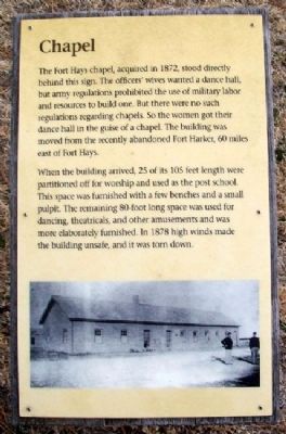
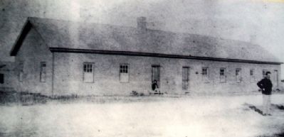
The Fort Hays chapel, acquired in 1872, stood directly behind this sign. The officers' wives wanted a dance hall, but army regulations prohibited the use of military labor and resources to build one. But there was no such regulations regarding chapels. So the women got their dance hall in the guise of a chapel. The building was moved from the recently abandoned Fort Harker, 60 miles east of Fort Hays.
When the building arrived, 25 of its 105 feet length were partitioned off for worship and used as the post school. This space was furnished with a few benches and a small pulpit. The remaining 80-foot long space was used for dancing, theatricals, and other amusements and was more elaborately furnished. In 1878 high winds made the building unsafe, and it was torn down.
Erected by Kansas Historical Society.
Topics. This historical marker is listed in these topic lists: Churches & Religion • Education • Entertainment • Forts and Castles. A significant historical year for this entry is 1872.
Location. 38° 51.713′ N, 99° 20.537′ W. Marker is in Hays, Kansas, in Ellis County. Marker is on the grounds of Fort Hays State Historic Site, off US Hwy 163 Alternate. Touch for map. Marker is at or near this postal address: 1472 US Highway 163 Alternate, Hays KS 67601, United States of America. Touch for directions.
Other nearby markers. At least 8 other markers are within walking distance of this marker. Icehouse (a few steps from this marker); Post Surgeon's Quarters (a few steps from this marker); Band Barracks (within shouting distance of this marker); Fort Hays Soldiers (within shouting distance of this marker); Post Trader's Store (within shouting distance of this marker); Blockhouse (within shouting distance of this marker); Laundress' Quarters (within shouting distance of this marker); Quartermaster's Complex (within shouting distance of this marker). Touch for a list and map of all markers in Hays.
Also see . . .
1. Fort Hays State Historic Site. (Submitted on September 25, 2012, by William Fischer, Jr. of Scranton, Pennsylvania.)
2. Fort Hays at Kansapedia. (Submitted on September 25, 2012, by William Fischer, Jr. of Scranton, Pennsylvania.)
Credits. This page was last revised on June 16, 2016. It was originally submitted on September 25, 2012, by William Fischer, Jr. of Scranton, Pennsylvania. This page has been viewed 342 times since then and 9 times this year. Photos: 1, 2, 3. submitted on September 25, 2012, by William Fischer, Jr. of Scranton, Pennsylvania.


