Near Marathon in Brewster County, Texas — The American South (West South Central)
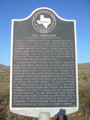
Los Caballos
(In Core of the Ouachita Structural Belt)
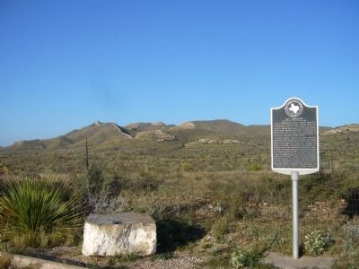
The northwesterly trending Del Norte-Santiago range (southmost extension of the Rocky Mountains) forms the southwestern skyline. The rocks of this range were deposited in a sea that covered the Ouachita Fold Belt after erosion had reduced the highlands and a later submergence lowered the area. Santiago Peak (named for a local man who was killed by Indians and buried beneath the peak) is the high, flat-topped mountain to the southwest. It was once a mass of molten magma that cooled and hardened underneath the earth's surface and was uncovered by later erosion. The Del Norte-Santiago range, uplifted and folded 40 to 60 million years ago, is not half the age of the Ouachita Fold. This is a remarkable fusion of "old" and "young" mountains—and is unmatched at any other site in North America.
Erected 1970 by State Historical Survey Committee. (Marker Number 3124.)
Topics. This historical marker is listed in this topic list: Natural Resources.
Location. 30° 4.003′ N, 103° 16.465′ W. Marker is near Marathon, Texas, in Brewster County. Marker is on U.S. 385, 10.3 miles south of U.S. 90, on the right when traveling south. Touch for map. Marker is in this post office area: Marathon TX 79842, United States of America. Touch for directions.
Other nearby markers. At least 7 other markers are within 11 miles of this marker, measured as the crow flies. Fort Peña Colorado (Red Rock) (approx. 6 miles away); Chambers Hotel (approx. 9.7 miles away); The Gage Hotel (approx. 9.8 miles away); Albion E. Shepard House (approx. 9.9 miles away); First School House (approx. 9.9 miles away); Marathon (approx. 10 miles away); Colonel Lewis Given Harman (approx. 10.7 miles away).
Credits. This page was last revised on June 16, 2016. It was originally submitted on November 7, 2012, by Bill Kirchner of Tucson, Arizona. This page has been viewed 755 times since then and 81 times this year. Photos: 1, 2, 3. submitted on November 7, 2012, by Bill Kirchner of Tucson, Arizona. • Bernard Fisher was the editor who published this page.


