Near Andrews in Andrews County, Texas — The American South (West South Central)
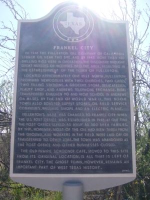
Frankel City
Located approximately one mile north, Fullerton provided newcomers with two churches, two cafes, two filling stations, a grocery store, delicatessen, beauty shop, and Andrews telephone exchange. Buses transported children to and from school in Andrews (16 mi. SE). By the end of World War II, the boom town also boasted supply stores, oil field service companies, welding shops, and an electric plant.
Fullerton's name was changed to Frankel City when the U.S. post office was established in 1948. At one time the post office served as many as 500 area families. By 1976, however, most of the oil had been taken from the ground, and workers in the field were laid off or transferred to other jobs. The town was abandoned as the post office and other businesses closed.
The old Prairie Schooner Cafe, moved to this site from its original location, is all that is left of Frankel City. The ghost town, however, remains an important part of West Texas history.
Erected 1984 by Texas Historical Commission. (Marker Number 2051.)
Topics and series. This historical marker is listed in this topic list: Settlements & Settlers. In addition, it is included in the Postal Mail and Philately series list. A significant historical year for this entry is 1941.
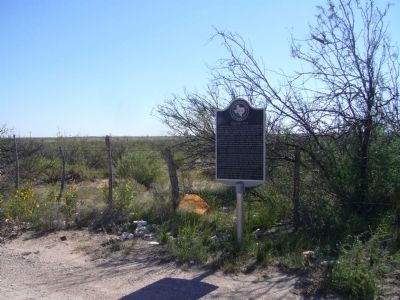
Location. 32° 21.482′ N, 102° 46.448′ W. Marker is near Andrews, Texas, in Andrews County. Marker is at the intersection of Eunice Highway (Route 176) and Farm to Market Road 181, on the right when traveling east on Eunice Highway. Marker is on the southwest corner. Touch for map. Marker is in this post office area: Andrews TX 79714, United States of America. Touch for directions.
Other nearby markers. At least 4 other markers are within 14 miles of this marker, measured as the crow flies. Andrews County (approx. 2 miles away); Shafter Lake Townsite (approx. 6.1 miles away); Andrews County Discovery Well (approx. 7 miles away); Florey Park (approx. 13.6 miles away).
Credits. This page was last revised on June 16, 2016. It was originally submitted on November 26, 2012, by Bill Kirchner of Tucson, Arizona. This page has been viewed 2,173 times since then and 149 times this year. Photos: 1, 2. submitted on November 26, 2012, by Bill Kirchner of Tucson, Arizona. • Bernard Fisher was the editor who published this page.

